|
search place name
|
||
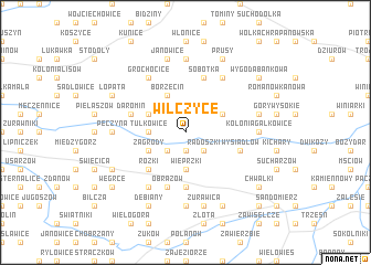
Wilczyce (Poland)Wilczyce is a town in Poland. An overview map of the region around Wilczyce is displayed below.
regional and 3d topo map of Wilczyce, Poland ::
Wilczyce airports ::
The nearest airport is RZE - Rzeszow Jasionka, located 75.5 km south of Wilczyce.
Other airports nearby include KRK - Krakow Balice (153.2 km south west), WAW - Warsaw Okecie (164.8 km north), TAT - Poprad Tatry (212.7 km south west), Nearby towns ::
Dacharzów (1.9km south) //
Radoszki (2.2km south east) //
Jankowice (2.2km south west) //
Wieprzki (3.7km south) //
Tułkowice (2.3km west) //
Łukawa (3.0km north east) //
Borzęcin (3.9km north) //
Zagrody (3.0km south west) //
Przezwody (3.0km north west) //
Rożki (4.4km south west) //
Lenarczyce (5.6km south) //
Sobótka (5.7km north) //
Obrazów (5.7km south) //
Wysiadłów (4.0km south east) //
Daromin (4.0km north west) //
Ocinek (4.0km south east) //
Pisary (6.0km north east) //
Głazów (6.0km south west) //
Grochocice (6.0km north west) //
Kolonia Gałkowice (4.7km east) //
Kichary Stare (4.7km east) //
Jakubowice (7.4km north) //
Pęczyna (4.7km west) //
Malice (7.4km south) //
Gałkowice (5.0km east) //
Żurawica (7.5km south) //
Janowice (7.5km north) //
Milczany (7.8km south) //
Prusy (7.8km north) //
[all distances 'as the bird flies' and approximate]  Places with similar names to Wilczyce, Poland ::
Disclaimer :: Information on this page comes without warranty of any kind |
||
|
Where is Wilczyce? Elevation and coordinates ::
Latitude (lat): 50°45'0"N Longitude (lon): 21°40'0"E
Elevation (approx.): 170m (map arrows pan, magnifying glasses zoom) |
||
|
Visiting Wilczyce? Hotel/Accommodation ::
Book a hotel in Wilczyce Travel Guide ::
Buy a travel guide for Poland rental cars ::
car rental offers GPS waypoint ::
download a GPX waypoint (PoI) of Wilczyce for your GPS receiver
|
||