|
search place name
|
||
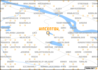
Wincentów (Poland)Wincentów is a town in Poland. An overview map of the region around Wincentów is displayed below.
regional and 3d topo map of Wincentów, Poland ::
Wincentów airports ::
The nearest airport is WAW - Warsaw Okecie, located 94.8 km east of Wincentów.
Other airports nearby include KTW - Katowice Pyrzowice (225.4 km south), GDN - Gdansk Lecha Walesy (227.1 km north), Nearby towns ::
Nowe Rumunki (0.0km north) //
Zaździerz (1.1km east) //
Zdwórz (3.7km south) //
Ciechomice (2.9km north east) //
Matyldów (2.9km south east) //
Gorzewo (5.6km south) //
Łąck (3.4km west) //
Górki (3.9km north east) //
Ludwików (3.9km south east) //
Zofiówka (6.0km south) //
Tokary Rąbierz (5.0km north east) //
Budki Ciechomice (5.0km north east) //
Annopol (6.0km south) //
Koszelówka (5.0km south east) //
Korzeń Królewski (5.0km south west) //
Koszelew (7.4km south) //
Nowe Budy (4.9km west) //
Kunki (7.5km south) //
Radziwie (7.7km north) //
Grabie Niemieckie (5.8km south east) //
Dzierzązna (7.7km north) //
Nizkie (5.8km south west) //
Smolenta (7.8km south) //
Korzeń Rządowy (7.2km south west) //
Gąbin (8.7km south east) //
Helenów (8.7km south west) //
[all distances 'as the bird flies' and approximate]  Places with similar names to Wincentów, Poland ::
Disclaimer :: Information on this page comes without warranty of any kind |
||
|
Where is Wincentów? Elevation and coordinates ::
Latitude (lat): 52°28'0"N Longitude (lon): 19°40'0"E
Elevation (approx.): 78m (map arrows pan, magnifying glasses zoom) |
||
|
Visiting Wincentów? Hotel/Accommodation ::
Book a hotel in Wincentów Travel Guide ::
Buy a travel guide for Poland rental cars ::
car rental offers GPS waypoint ::
download a GPX waypoint (PoI) of Wincentów for your GPS receiver
|
||