|
search place name
|
||
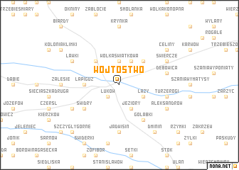
Wójtostwo (Poland)Wójtostwo is a town in Poland. An overview map of the region around Wójtostwo is displayed below.
regional and 3d topo map of Wójtostwo, Poland ::
Wójtostwo airports ::
The nearest airport is WAW - Warsaw Okecie, located 101.6 km west of Wójtostwo.
Other airports nearby include RZE - Rzeszow Jasionka (204.6 km south), Nearby towns ::
Łuków (2.2km south west) //
Wólka Świątkowa (3.7km north) //
Łazy (2.9km south east) //
Jeziory (3.9km south) //
Role (3.9km north) //
Gołaszyn (4.4km north west) //
Suleje (4.4km north east) //
Łapiguz (3.4km west) //
Świdry (5.0km south west) //
Gołąbki (6.0km south) //
Jadwisin (7.4km south) //
Turzerogi (4.9km east) //
Dębowica (4.9km east) //
Ryżki (5.9km south west) //
Aleksandrów (5.9km south east) //
Ławki (5.9km north west) //
Nurzyna (5.9km north east) //
Świercze (5.9km north east) //
Dminin (8.2km south east) //
Celiny (7.2km north east) //
Szczygły Górne (8.7km south west) //
[all distances 'as the bird flies' and approximate]  Places with similar names to Wójtostwo, Poland ::
Disclaimer :: Information on this page comes without warranty of any kind |
||
|
Where is Wójtostwo? Elevation and coordinates ::
Latitude (lat): 51°56'0"N Longitude (lon): 22°24'0"E
Elevation (approx.): 156m (map arrows pan, magnifying glasses zoom) |
||
|
Visiting Wójtostwo? Hotel/Accommodation ::
Book a hotel in Wójtostwo Travel Guide ::
Buy a travel guide for Poland rental cars ::
car rental offers GPS waypoint ::
download a GPX waypoint (PoI) of Wójtostwo for your GPS receiver
|
||