|
search place name
|
||
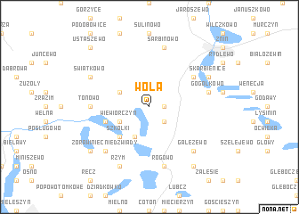
Wola (Poland)Wola is a town in Poland. An overview map of the region around Wola is displayed below.
regional and 3d topo map of Wola, Poland ::
Wola airports ::
The nearest airport is POZ - Poznan Lawica, located 68.8 km south west of Wola.
Other airports nearby include IEG - Zielona Gora Babimost (144.9 km south west), GDN - Gdansk Lecha Walesy (185.5 km north), OSP - Slupsk Redzikowo (192.1 km north), WRO - Wroclaw Strachowice (194.2 km south), Nearby towns ::
Czewujewo (1.1km east) //
Grochowiska Księże (2.2km south east) //
Wiewiórczyn (2.9km south west) //
Kaczkowo (2.9km north west) //
Izdebno (3.9km south) //
Szkółki (4.3km south west) //
Skórki (3.8km south west) //
Bożejewice (5.0km north east) //
Tonowo (4.5km west) //
Rogowo (7.5km south) //
Rogówko (7.5km south) //
Sarbinowo (7.5km north) //
Gogółkowo (4.9km east) //
Żórawiniec Niedźwiady (6.5km south west) //
Gałęzewo (6.5km south east) //
Rzym (7.7km south) //
Świątkowo (5.8km north west) //
Skarbienice (5.8km north east) //
Gałezewko (8.1km south east) //
Kołdrąb (7.1km south west) //
Ustaszewo (8.7km north west) //
[all distances 'as the bird flies' and approximate] 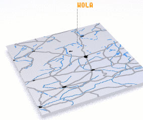 Places with similar names to Wola, Poland ::
Disclaimer :: Information on this page comes without warranty of any kind |
||
|
Where is Wola? Elevation and coordinates ::
Latitude (lat): 52°47'0"N Longitude (lon): 17°39'0"E
Elevation (approx.): 107m (map arrows pan, magnifying glasses zoom) |
||
|
Visiting Wola? Hotel/Accommodation ::
Book a hotel in Wola Travel Guide ::
Buy a travel guide for Poland rental cars ::
car rental offers GPS waypoint ::
download a GPX waypoint (PoI) of Wola for your GPS receiver
|
||