|
search place name
|
||
Wola Łaska (Poland)Wola Łaska is a town in Poland. An overview map of the region around Wola Łaska is displayed below.
regional and 3d topo map of Wola Łaska, Poland ::

Wola Łaska airports ::
The nearest airport is KTW - Katowice Pyrzowice, located 123.5 km south of Wola Łaska.
Other airports nearby include WAW - Warsaw Okecie (139.9 km north east), KRK - Krakow Balice (173.1 km south), OSR - Ostrava Mosnov (222.8 km south), Nearby towns ::
Ostrów (1.2km east) //
Mauryca (1.9km south) //
Gorczyn (1.2km west) //
Częstków A (2.2km south west) //
Teodory (2.3km east) //
Łask (2.3km west) //
Wronowice (3.7km north) //
Aleksandrówek (3.0km south east) //
Częstków (3.9km south) //
Kolumna (3.9km north) //
Utrata (3.0km north west) //
Częstków B (4.4km south west) //
Wiewiórczyn (4.4km north west) //
Wilkowyja (5.7km south) //
Łopatki (3.9km south west) //
Buczkowska Wola (5.7km south) //
Barycz (3.9km north east) //
Brodnia (6.0km south east) //
Wymysłów (5.1km south east) //
Anielin (6.0km north) //
Orchów (5.1km north west) //
Buczek Wygwizdów (7.4km south) //
Buczek (7.4km south) //
Rembów (7.4km north) //
Rokitnica (5.0km east) //
Buczek Szadek (7.5km south) //
Sięganów (5.0km west) //
Orpelów (6.5km north east) //
Piaskowice (6.5km south east) //
[all distances 'as the bird flies' and approximate] 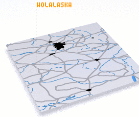 Places with similar names to Wola Łaska, Poland ::
// Wola Łuski (PL)
Disclaimer :: Information on this page comes without warranty of any kind |
||
|
Where is Wola Łaska? Elevation and coordinates ::
Latitude (lat): 51°35'0"N Longitude (lon): 19°10'0"E
Elevation (approx.): 184m (map arrows pan, magnifying glasses zoom) |
||
|
Visiting Wola Łaska? Hotel/Accommodation ::
Book a hotel in Wola Łaska Travel Guide ::
Buy a travel guide for Poland rental cars ::
car rental offers GPS waypoint ::
download a GPX waypoint (PoI) of Wola Łaska for your GPS receiver
|
||