|
search place name
|
||
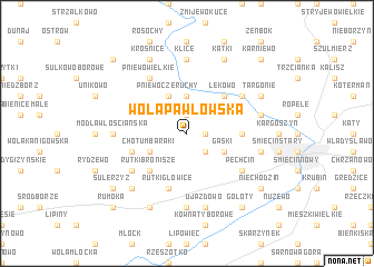
Wola Pawłowska (Poland)Wola Pawłowska is a town in Poland. An overview map of the region around Wola Pawłowska is displayed below.
regional and 3d topo map of Wola Pawłowska, Poland ::
Wola Pawłowska airports ::
The nearest airport is WAW - Warsaw Okecie, located 87.2 km south of Wola Pawłowska.
Other airports nearby include KGD - Kaliningrad Khrabrovo (221.6 km north), Nearby towns ::
Gorysze (1.1km east) //
Pawłówko (1.1km east) //
Pawłowo (1.9km north) //
Rutki Marszewice (2.2km south east) //
Lekowiec (3.7km north) //
Pniewo Czeruchy (3.9km north) //
Gąski (2.9km south east) //
Chotum Baraki (2.9km south west) //
Lekowo (4.3km north east) //
Rutki Bronisze (4.3km south west) //
Rutki Borki (4.3km south west) //
Chruszczewo (3.4km east) //
Rutki Głowice (5.7km south) //
Chotum (3.8km south west) //
Nowa Wieś (5.0km south west) //
Pęchcin (5.0km south east) //
Regimin (5.0km north east) //
Pniewo Wielkie (6.0km north) //
Modła Włościańska (4.5km west) //
Klice (7.4km north) //
Modełka (4.5km west) //
Modła Szlachecka (4.5km west) //
Rykaczewo (7.4km south) //
Grzybowo (4.8km north east) //
Kargoszynek (4.8km east) //
Ujazdowo (7.5km south) //
Kanigówek (6.5km south west) //
Targonie (5.8km north east) //
Kątki (7.7km north) //
[all distances 'as the bird flies' and approximate] 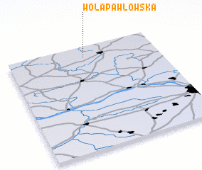 Places with similar names to Wola Pawłowska, Poland ::
Disclaimer :: Information on this page comes without warranty of any kind |
||
|
Where is Wola Pawłowska? Elevation and coordinates ::
Latitude (lat): 52°54'0"N Longitude (lon): 20°31'0"E
Elevation (approx.): 139m (map arrows pan, magnifying glasses zoom) |
||
|
Visiting Wola Pawłowska? Hotel/Accommodation ::
Book a hotel in Wola Pawłowska Travel Guide ::
Buy a travel guide for Poland rental cars ::
car rental offers GPS waypoint ::
download a GPX waypoint (PoI) of Wola Pawłowska for your GPS receiver
|
||