|
search place name
|
||
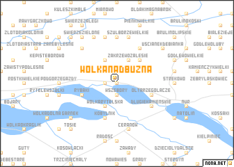
Wólka Nadbuźna (Poland)Wólka Nadbuźna is a town in Poland. An overview map of the region around Wólka Nadbuźna is displayed below.
regional and 3d topo map of Wólka Nadbuźna, Poland ::
Wólka Nadbuźna airports ::
The nearest airport is WAW - Warsaw Okecie, located 103.7 km south west of Wólka Nadbuźna.
Nearby towns ::
Zakrzewo Słomy (0.0km north) //
Zakrzewo Wielkie (1.9km north) //
Wszebory (1.9km south) //
Zgleczewo Szlacheckie (1.1km west) //
Zakrzewo Zalesie (3.9km north) //
Zakrzewo Kopijki (3.9km north) //
Pętkowo Wymiarowo (3.9km north) //
Zuzela (2.9km north east) //
Wólka Rytelska (3.9km south) //
Pętkowo Wielkie (2.9km north west) //
Smolewo (4.3km north east) //
Kałęczyn (3.8km north east) //
Ołtarze Gołacze (3.8km south east) //
Rytele Olechny (3.8km south west) //
Rybaki (3.8km south west) //
Kobylnik (5.7km south) //
Janczewo Wielkie (6.0km north) //
Długie Kamieńskie (5.0km south east) //
Szulborze Koty (7.4km north) //
Leśniewo (7.4km north) //
Szulborze (7.4km north) //
Szulborze Wielkie (7.5km north) //
Ceranów (7.5km south) //
Grędzice (7.5km north) //
Świerże Kolonie (6.5km north west) //
Kietlanka (6.5km north west) //
Świerże Leśniewek (7.7km north) //
Uścianek Dębianka (7.1km north east) //
Świerże Zielone (8.1km north west) //
[all distances 'as the bird flies' and approximate]  Places with similar names to Wólka Nadbuźna, Poland :: Disclaimer :: Information on this page comes without warranty of any kind |
||
|
Where is Wólka Nadbuźna? Elevation and coordinates ::
Latitude (lat): 52°42'0"N Longitude (lon): 22°13'0"E
Elevation (approx.): 102m (map arrows pan, magnifying glasses zoom) |
||
|
Visiting Wólka Nadbuźna? Hotel/Accommodation ::
Book a hotel in Wólka Nadbuźna Travel Guide ::
Buy a travel guide for Poland rental cars ::
car rental offers GPS waypoint ::
download a GPX waypoint (PoI) of Wólka Nadbuźna for your GPS receiver
|
||