|
search place name
|
||
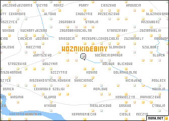
Woźniki Dębiny (Poland)Woźniki Dębiny is a town in Poland. An overview map of the region around Woźniki Dębiny is displayed below.
regional and 3d topo map of Woźniki Dębiny, Poland ::
Woźniki Dębiny airports ::
The nearest airport is WAW - Warsaw Okecie, located 85.3 km south east of Woźniki Dębiny.
Other airports nearby include GDN - Gdansk Lecha Walesy (221.7 km north west), Nearby towns ::
Radzanowo Dąbrowa (1.9km south) //
Radzanowo Dębniki (1.9km south) //
Radzanowo (1.1km west) //
Wólka (2.2km south east) //
Woźniki (2.2km north west) //
Ciołkowo (2.2km north west) //
Łoniewo (2.3km east) //
Ślepkowo Królewskie (2.3km west) //
Smardzewo (3.7km north) //
Kosino (3.9km south) //
Czerniewo (2.9km north east) //
Chełstowo (3.9km south) //
Mikołajewo (3.9km north) //
Ślepkowo Szlacheckie (2.9km north west) //
Przedpełce Kościołki (4.3km north east) //
Opatówiec (4.3km north east) //
Ciołkówko (4.3km north west) //
Śniegocin (4.3km north west) //
Święcieniec (5.6km south) //
Sochocino-Praga (3.4km east) //
Wołowa (3.9km south east) //
Zagroba Kościelna (5.7km north) //
Aleksandrowo (5.7km north) //
Ślepkowo (3.9km north west) //
Kanigowo (6.0km south) //
Szczytno (5.0km south west) //
Samborz (6.0km south) //
Mijakowo (6.0km south) //
Przedpełce (5.0km north east) //
[all distances 'as the bird flies' and approximate]  Places with similar names to Woźniki Dębiny, Poland :: Disclaimer :: Information on this page comes without warranty of any kind |
||
|
Where is Woźniki Dębiny? Elevation and coordinates ::
Latitude (lat): 52°35'0"N Longitude (lon): 19°55'0"E
Elevation (approx.): 133m (map arrows pan, magnifying glasses zoom) |
||
|
Visiting Woźniki Dębiny? Hotel/Accommodation ::
Book a hotel in Woźniki Dębiny Travel Guide ::
Buy a travel guide for Poland rental cars ::
car rental offers GPS waypoint ::
download a GPX waypoint (PoI) of Woźniki Dębiny for your GPS receiver
|
||