|
search place name
|
||
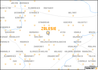
Zalesie (Poland)Zalesie is a town in Poland. An overview map of the region around Zalesie is displayed below.
regional and 3d topo map of Zalesie, Poland ::
Nearby towns ::
Achrymowce (1.9km south) //
Litwinki (2.2km south west) //
Cimanie (3.7km south) //
Bieniasze (2.2km west) //
Bierniki (3.7km north) //
Mieleszkowce Pawłowickie (3.9km south) //
Sniczany (2.9km south west) //
Długosielce (2.9km north east) //
Staworowo (3.9km north) //
Starowlany (5.6km south) //
Wyzgi (3.3km east) //
Ogrodniki (3.3km west) //
Zwierzany (6.0km south) //
Podsudki (5.0km north west) //
Jurasze (4.4km west) //
Wołkusz (7.7km south) //
Gliniszcze Wielkie (7.7km south) //
Kuścińce (5.8km north east) //
Gliniszcze Małe (8.1km south west) //
Synkowce (8.1km north west) //
[all distances 'as the bird flies' and approximate]  Places with similar names to Zalesie, Poland ::
Disclaimer :: Information on this page comes without warranty of any kind |
||
|
Where is Zalesie? Elevation and coordinates ::
Latitude (lat): 53°33'0"N Longitude (lon): 23°33'0"E
Elevation (approx.): 174m (map arrows pan, magnifying glasses zoom) |
||
|
Visiting Zalesie? Hotel/Accommodation ::
Book a hotel in Zalesie Travel Guide ::
Buy a travel guide for Poland rental cars ::
car rental offers GPS waypoint ::
download a GPX waypoint (PoI) of Zalesie for your GPS receiver
|
||