|
search place name
|
||
Zdziar Łopatki (Poland)Zdziar Łopatki is a town in Poland. An overview map of the region around Zdziar Łopatki is displayed below.
regional and 3d topo map of Zdziar Łopatki, Poland ::

Zdziar Łopatki airports ::
The nearest airport is WAW - Warsaw Okecie, located 80.4 km south east of Zdziar Łopatki.
Other airports nearby include GDN - Gdansk Lecha Walesy (221.3 km north west), Nearby towns ::
Zdziar Wielki (1.1km west) //
Bylino (2.2km south east) //
Rogowo Falęcin (2.2km south east) //
Przedbórz (2.2km north west) //
Dłużniewo Małe (3.7km north) //
Nowa Wieś (3.9km south) //
Rogowo (2.9km south east) //
Szulbory (3.9km south) //
Góra (2.9km north east) //
Dłużniewo Duże (3.9km north) //
Dłużniewo (3.9km north) //
Bromierzyk (4.3km north west) //
Słupca (5.6km south) //
Karwowo Podgórne (3.4km east) //
Worowice-Wyroby (3.4km west) //
Zdziar Mały (3.9km south west) //
Łubki (5.7km south) //
Parcele Bromierzyk (3.8km north west) //
Rogotworsk (5.7km north) //
Ostrzykowo (5.0km south west) //
Nadułki (6.0km south) //
Dobrskie (6.0km north) //
Parcele łubki (6.0km south) //
Małachowo (6.0km north) //
Wepiły (7.5km north) //
Wrogocin (6.5km north west) //
Dobrskie Nowiny (7.7km north) //
Bromierz (5.8km north west) //
Bulkowo (8.1km south east) //
[all distances 'as the bird flies' and approximate] 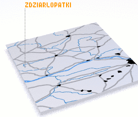 Places with similar names to Zdziar Łopatki, Poland :: Disclaimer :: Information on this page comes without warranty of any kind |
||
|
Where is Zdziar Łopatki? Elevation and coordinates ::
Latitude (lat): 52°38'0"N Longitude (lon): 20°4'0"E
Elevation (approx.): 132m (map arrows pan, magnifying glasses zoom) |
||
|
Visiting Zdziar Łopatki? Hotel/Accommodation ::
Book a hotel in Zdziar Łopatki Travel Guide ::
Buy a travel guide for Poland rental cars ::
car rental offers GPS waypoint ::
download a GPX waypoint (PoI) of Zdziar Łopatki for your GPS receiver
|
||