|
search place name
|
||
Zygry (Poland)Zygry is a town in Poland. An overview map of the region around Zygry is displayed below.
regional and 3d topo map of Zygry, Poland ::

Zygry airports ::
The nearest airport is KTW - Katowice Pyrzowice, located 144.1 km south of Zygry.
Other airports nearby include KRK - Krakow Balice (196.8 km south), Nearby towns ::
Zaborów (1.1km east) //
Chodaki (2.2km north west) //
Zalesie (2.2km south west) //
Osina Mała (2.2km south east) //
Bogucice (2.2km south east) //
Choszczewo (3.7km south) //
Kobyla Miejska (3.7km south) //
Otok (2.9km north west) //
Iwonie (3.9km north) //
Dzierzązna Szlachecka (4.4km north east) //
Prusinowice (4.4km south west) //
Krokocka Wola (4.4km south east) //
Lichawa (3.4km east) //
Górki Zadzimskie (3.9km north west) //
Stefanów (3.9km north east) //
Anusin (5.7km north) //
Krokocice (3.9km south east) //
Borki (3.9km south west) //
Przedmieście Uniejowska-Szosa (5.7km south) //
Piotrów (6.0km north) //
Grzybów (6.0km south) //
Kolonia Pudłów (7.4km north) //
Wola Zaleska (4.6km west) //
Kłoniszew (4.9km east) //
Karczówek (7.5km south) //
Łobudzice (4.9km east) //
Bratków Górny (6.5km north west) //
Ruda Jeżewska (6.5km north east) //
Czarny Las (6.5km south west) //
[all distances 'as the bird flies' and approximate] 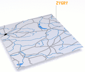 Places with similar names to Zygry, Poland ::
Disclaimer :: Information on this page comes without warranty of any kind |
||
|
Where is Zygry? Elevation and coordinates ::
Latitude (lat): 51°46'0"N Longitude (lon): 18°57'0"E
Elevation (approx.): 134m (map arrows pan, magnifying glasses zoom) |
||
|
Visiting Zygry? Hotel/Accommodation ::
Book a hotel in Zygry Travel Guide ::
Buy a travel guide for Poland rental cars ::
car rental offers GPS waypoint ::
download a GPX waypoint (PoI) of Zygry for your GPS receiver
|
||