|
search place name
|
||
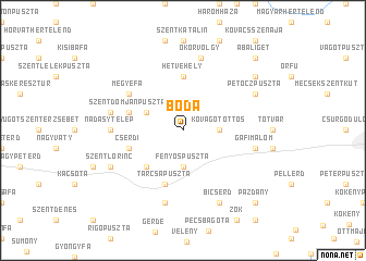
Boda (Baranya, Hungary)Boda is a town in the Baranya region of Hungary. An overview map of the region around Boda is displayed below.
regional and 3d topo map of Boda, Hungary ::
Boda airports ::
The nearest airport is OSI - Osijek, located 90.9 km south east of Boda.
Other airports nearby include ZAG - Zagreb (158.3 km west), BUD - Budapest Ferihegy (176.4 km north east), Nearby towns ::
Bakonya (2.6km east) //
Kővágótőttős (2.6km east) //
Fenyőspuszta (3.7km south) //
Szentdomján (3.2km north west) //
Keresztespuszta (4.5km south west) //
Hetvehely (5.6km north) //
Cserdi (4.3km south west) //
Tarcsapuszta (5.7km south) //
Kishegy (4.3km north west) //
Szentdomjánpuszta (4.3km north west) //
Megyefa (5.3km north west) //
Helesfa (5.1km west) //
Nádasytelep (5.1km west) //
Szabadszentkirály (7.5km south) //
Gáfimalom (5.5km east) //
Okorvölgy (7.5km north) //
Bükkösd (5.5km west) //
Bicsérd (7.8km south) //
Sántamalom (7.8km south) //
Bicsérd (7.8km south) //
Szentlőrinc (6.3km south west) //
Petőczpuszta (6.3km north east) //
Somogyitanya (7.6km north east) //
Pázdány (9.0km south east) //
Abaliget (9.0km north east) //
[all distances 'as the bird flies' and approximate] 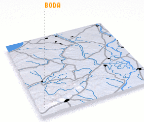 Places with similar names to Boda, Hungary ::
Disclaimer :: Information on this page comes without warranty of any kind |
||
|
Where is Boda? Elevation and coordinates ::
Latitude (lat): 46°5'0"N Longitude (lon): 18°3'0"E
Elevation (approx.): 203m (map arrows pan, magnifying glasses zoom) |
||
|
Visiting Boda? Hotel/Accommodation ::
Book a hotel in Boda Travel Guide ::
Buy a travel guide for Hungary rental cars ::
car rental offers GPS waypoint ::
download a GPX waypoint (PoI) of Boda for your GPS receiver
|
||