|
search place name
|
||
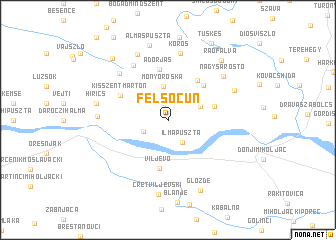
Felsőcún (Baranya, Hungary)Felsőcún is a town in the Baranya region of Hungary. An overview map of the region around Felsőcún is displayed below.
regional and 3d topo map of Felsőcún, Hungary ::
Felsőcún airports ::
The nearest airport is OSI - Osijek, located 68.7 km south east of Felsőcún.
Other airports nearby include BUD - Budapest Ferihegy (203.3 km north east), SJJ - Sarajevo (220.5 km south), Nearby towns ::
Cún (1.4km north) //
Majláthpuszta (2.3km south west) //
Ilmapuszta (2.8km south east) //
Monyoróska (3.7km north) //
Szaporca (3.0km north east) //
Kémes (3.5km north east) //
Tésenfa (3.9km east) //
Ereszvény (4.7km north east) //
Viljevo (5.4km south) //
Drávapiski (5.0km north east) //
Adorjás (5.7km north) //
Kisszentmárton (4.6km north west) //
Sámod (6.6km north west) //
Baranyahidvég (6.4km north west) //
Kórós (7.5km north) //
Nagysárostó (6.5km north east) //
Kelemenliget (5.5km west) //
Szekerekpuszta (7.6km north) //
Drávacsepely (6.1km north east) //
Hirics (5.9km west) //
Cret Viljevski (8.4km south) //
Almáspuszta (8.4km north) //
Gložđe (8.3km south) //
Rádfalva (7.9km north east) //
Kiságpuszta (8.1km north west) //
Tüskés (9.1km north) //
[all distances 'as the bird flies' and approximate]  Places with similar names to Felsőcún, Hungary ::
Disclaimer :: Information on this page comes without warranty of any kind |
||
|
Where is Felsőcún? Elevation and coordinates ::
Latitude (lat): 45°48'0"N Longitude (lon): 18°4'18"E
Elevation (approx.): 91m (map arrows pan, magnifying glasses zoom) |
||
|
Visiting Felsőcún? Hotel/Accommodation ::
Book a hotel in Felsőcún Travel Guide ::
Buy a travel guide for Hungary rental cars ::
car rental offers GPS waypoint ::
download a GPX waypoint (PoI) of Felsőcún for your GPS receiver
|
||