|
search place name
|
||
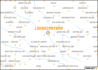
Lovászpatona (Veszprém, Hungary)Lovászpatona is a town in the Veszprém region of Hungary. An overview map of the region around Lovászpatona is displayed below.
regional and 3d topo map of Lovászpatona, Hungary ::
Lovászpatona airports ::
The nearest airport is BTS - Bratislava M R Stefanik, located 87.8 km north of Lovászpatona.
Other airports nearby include VIE - Vienna Schwechat (109.6 km north west), BUD - Budapest Ferihegy (122.4 km east), PZY - Piestany (133.3 km north), SLD - Sliac (174.5 km north east), Nearby towns ::
Pölöskeitanya (0.0km north) //
Öreghegy (0.0km north) //
Nagytelep (0.0km north) //
Malom (0.0km north) //
Újhegy (1.3km west) //
Heiterpuszta (1.3km east) //
Bakonyság (3.9km south) //
Csárdapuszta (3.9km south) //
Alsószalmavár (4.5km south west) //
Bakonyszentiván (4.5km south east) //
Miklósmajor (4.5km north east) //
Homok (5.6km north) //
Füzesdůlő (5.6km north) //
Kajárpéc (5.6km north) //
Úrházimalom (3.8km east) //
Nagydém (3.8km east) //
Hangyálostanya (5.6km south) //
Kovácstag (6.1km north west) //
Kisdémpuszta (5.3km south east) //
Csót (7.5km south) //
Sárkánymajor (7.5km north) //
Hidegvölgymajor (5.3km east) //
Vanyola (6.7km south west) //
Hollómajor (7.8km north) //
Zsörk (8.3km south east) //
Járóháza (8.3km south west) //
Sokorópátka (7.5km north east) //
Fényeshegy (7.5km south east) //
Pápateszér (7.5km south east) //
[all distances 'as the bird flies' and approximate] 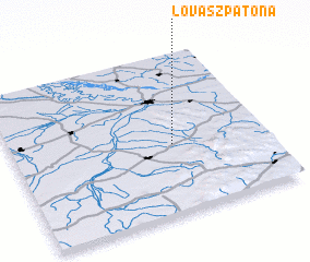 Places with similar names to Lovászpatona, Hungary :: Disclaimer :: Information on this page comes without warranty of any kind |
||
|
Where is Lovászpatona? Elevation and coordinates ::
Latitude (lat): 47°26'0"N Longitude (lon): 17°38'0"E
Elevation (approx.): 152m (map arrows pan, magnifying glasses zoom) |
||
|
Visiting Lovászpatona? Hotel/Accommodation ::
Book a hotel in Lovászpatona Travel Guide ::
Buy a travel guide for Hungary rental cars ::
car rental offers GPS waypoint ::
download a GPX waypoint (PoI) of Lovászpatona for your GPS receiver
|
||