|
search place name
|
||
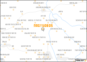
Nagydobos (Szabolcs-Szatmár-Bereg, Hungary)Nagydobos is a town in the Szabolcs-Szatmár-Bereg region of Hungary. An overview map of the region around Nagydobos is displayed below.
regional and 3d topo map of Nagydobos, Hungary ::
Nagydobos airports ::
The nearest airport is SUJ - Satu Mare, located 57.4 km south east of Nagydobos.
Other airports nearby include DEB - Debrecen (81.6 km south west), BAY - Baia Mare Tautii Magheraus (96.7 km south east), KSC - Kosice (104.9 km north west), OMR - Oradea (118.1 km south), Nearby towns ::
Gizellatanya (2.2km north west) //
Olcsva (3.9km north) //
Perényitanya (3.9km south) //
Nyírparasznya (3.1km south west) //
Kistanya (3.1km south west) //
Olcsvaapáti (4.5km north east) //
Károlyitanya (4.5km north west) //
Farkastanya (5.6km south) //
Ópályi (5.6km south) //
Szamosszeg (3.7km east) //
Vitka (5.6km north) //
Petőfitanya (5.6km north) //
Horváthtanya (5.7km south) //
Molnártanya (5.7km south) //
Grüntanya (5.7km south) //
Vajastanya (4.2km south west) //
Friedtanya (6.1km south east) //
Jánd (8.9km north east) //
Dimatanya (8.9km south west) //
Papos (8.9km south west) //
[all distances 'as the bird flies' and approximate] 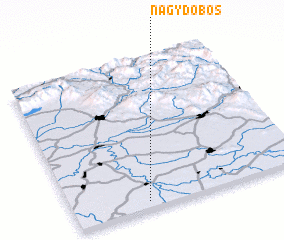 Places with similar names to Nagydobos, Hungary :: Disclaimer :: Information on this page comes without warranty of any kind |
||
|
Where is Nagydobos? Elevation and coordinates ::
Latitude (lat): 48°3'0"N Longitude (lon): 22°19'0"E
Elevation (approx.): 110m (map arrows pan, magnifying glasses zoom) |
||
|
Visiting Nagydobos? Hotel/Accommodation ::
Book a hotel in Nagydobos Travel Guide ::
Buy a travel guide for Hungary rental cars ::
car rental offers GPS waypoint ::
download a GPX waypoint (PoI) of Nagydobos for your GPS receiver
|
||