|
search place name
|
||
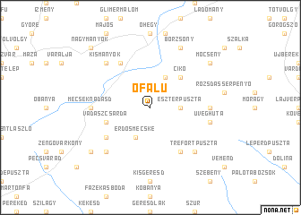
Ófalu (Baranya, Hungary)Ófalu is a town in the Baranya region of Hungary. An overview map of the region around Ófalu is displayed below.
regional and 3d topo map of Ófalu, Hungary ::
Ófalu airports ::
The nearest airport is OSI - Osijek, located 86.5 km south of Ófalu.
Other airports nearby include BUD - Budapest Ferihegy (146.4 km north), BEG - Beograd (208.3 km south east), BTS - Bratislava M R Stefanik (239.1 km north west), VIE - Vienna Schwechat (257.8 km north west), Nearby towns ::
Eszterpuszta (2.6km east) //
Berekaljapuszta (3.9km north) //
Erdősmecske (3.9km south) //
Cikó (4.5km north east) //
Vadászcsárda (4.3km south west) //
Hidas (6.1km north west) //
Apátvarasd (5.3km south west) //
Feked (6.1km south east) //
Egermalom (6.1km south east) //
Mecseknádasd (5.1km west) //
Bátaapáti (5.1km east) //
Üveghuta (5.5km east) //
Lovászhetény (6.8km south west) //
Trefortpuszta (6.8km south east) //
Kismányok (6.8km north west) //
Alsóbörzsöny (7.8km north) //
Börzsöny (7.8km north) //
Pusztakisfalu (7.6km south west) //
Mőcsény (7.6km north east) //
Nagymányok (9.0km north west) //
[all distances 'as the bird flies' and approximate]  Places with similar names to Ófalu, Hungary ::
Disclaimer :: Information on this page comes without warranty of any kind |
||
|
Where is Ófalu? Elevation and coordinates ::
Latitude (lat): 46°13'0"N Longitude (lon): 18°32'0"E
Elevation (approx.): 217m (map arrows pan, magnifying glasses zoom) |
||
|
Visiting Ófalu? Hotel/Accommodation ::
Book a hotel in Ófalu Travel Guide ::
Buy a travel guide for Hungary rental cars ::
car rental offers GPS waypoint ::
download a GPX waypoint (PoI) of Ófalu for your GPS receiver
|
||