|
search place name
|
||
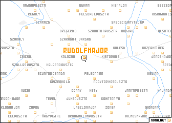
Rudolfmajor (Tolna, Hungary)Rudolfmajor is a town in the Tolna region of Hungary. An overview map of the region around Rudolfmajor is displayed below.
regional and 3d topo map of Rudolfmajor, Hungary ::
Rudolfmajor airports ::
The nearest airport is OSI - Osijek, located 117.5 km south of Rudolfmajor.
Other airports nearby include BUD - Budapest Ferihegy (118.4 km north east), BTS - Bratislava M R Stefanik (210.2 km north west), VIE - Vienna Schwechat (231.8 km north west), BEG - Beograd (233.3 km south east), Nearby towns ::
Varsád (3.7km north) //
Kalaznó (2.6km west) //
Felsőnána (3.9km south) //
Szakadát (4.5km north west) //
Murga (4.5km south west) //
Kistormás (3.8km east) //
Ferenckút (5.7km south) //
Kalaznópuszta (4.3km south west) //
Szabatonpuszta (6.1km north east) //
Öregerdő (6.1km north west) //
Gyönk (6.1km north west) //
Kölesd (5.4km east) //
Kölesdimajor (5.4km east) //
Kéty (7.5km south) //
Ódány (7.5km south) //
Grízenvald (6.8km south west) //
Felsőcsurgó (6.8km south west) //
Nagytormáspuszta (6.8km south east) //
Diósberény (6.3km north west) //
Szúnyogcsárda (6.3km south west) //
Hangospuszta (8.3km north east) //
Alsópél (8.3km north east) //
[all distances 'as the bird flies' and approximate] 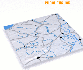 Places with similar names to Rudolfmajor, Hungary :: Disclaimer :: Information on this page comes without warranty of any kind |
||
|
Where is Rudolfmajor? Elevation and coordinates ::
Latitude (lat): 46°30'0"N Longitude (lon): 18°31'0"E
Elevation (approx.): 165m (map arrows pan, magnifying glasses zoom) |
||
|
Visiting Rudolfmajor? Hotel/Accommodation ::
Book a hotel in Rudolfmajor Travel Guide ::
Buy a travel guide for Hungary rental cars ::
car rental offers GPS waypoint ::
download a GPX waypoint (PoI) of Rudolfmajor for your GPS receiver
|
||