|
search place name
|
||
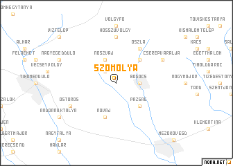
Szomolya (Borsod-Abaúj-Zemplén, Hungary)Szomolya is a town in the Borsod-Abaúj-Zemplén region of Hungary. An overview map of the region around Szomolya is displayed below.
regional and 3d topo map of Szomolya, Hungary ::
Szomolya airports ::
The nearest airport is DEB - Debrecen, located 95.4 km south east of Szomolya.
Other airports nearby include KSC - Kosice (101.1 km north east), BUD - Budapest Ferihegy (106.7 km south west), SLD - Sliac (130.4 km north west), TAT - Poprad Tatry (131.9 km north), Nearby towns ::
Bertamajor (2.2km north west) //
Bogács (2.5km east) //
Noszvaj (3.9km north) //
Pazsag (4.5km south east) //
Cserépfalu (4.5km north east) //
Novaj (5.7km south) //
Oszla (6.1km north east) //
Hidegpataka (6.1km north east) //
Bükkzsérc (7.4km north) //
Hosszúvölgy (7.4km north) //
Ostoros (6.2km south west) //
Cserépváralja (6.2km north east) //
[all distances 'as the bird flies' and approximate] 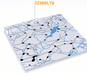 Places with similar names to Szomolya, Hungary :: Disclaimer :: Information on this page comes without warranty of any kind |
||
|
Where is Szomolya? Elevation and coordinates ::
Latitude (lat): 47°54'0"N Longitude (lon): 20°30'0"E
Elevation (approx.): 232m (map arrows pan, magnifying glasses zoom) |
||
|
Visiting Szomolya? Hotel/Accommodation ::
Book a hotel in Szomolya Travel Guide ::
Buy a travel guide for Hungary rental cars ::
car rental offers GPS waypoint ::
download a GPX waypoint (PoI) of Szomolya for your GPS receiver
|
||