|
search place name
|
||
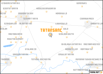
Tatársánc (Békés, Hungary)Tatársánc is a town in the Békés region of Hungary. An overview map of the region around Tatársánc is displayed below.
regional and 3d topo map of Tatársánc, Hungary ::
Tatársánc airports ::
The nearest airport is ARW - Arad, located 52.4 km south east of Tatársánc.
Other airports nearby include TSR - Timisoara Traian Vuia (88.5 km south east), OMR - Oradea (104.6 km north east), DEB - Debrecen (127.5 km north east), BUD - Budapest Ferihegy (155.1 km north west), Nearby towns ::
Csúcsdůlő (3.7km north) //
Pásztordůlő (3.2km north east) //
Lapálydůlő (4.5km north east) //
Ludvigdůlő (4.5km north east) //
Pusztaföldvár (4.5km north east) //
Szőlőspuszta (3.8km east) //
Mákosdůlő (4.3km north east) //
Kaszaper (6.3km south east) //
Iskoladůlőitanyák (6.3km south east) //
Homokdůlő (7.8km north) //
Árpádtelep (7.5km south east) //
Melindaitanyák (8.3km south west) //
Szikháttanya (7.5km north west) //
Gyulamező (7.5km south west) //
Érdůlőitanyák (8.3km south east) //
[all distances 'as the bird flies' and approximate] 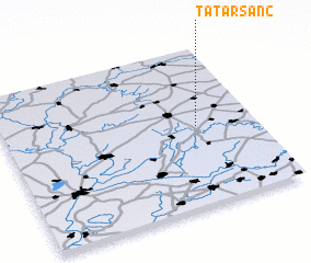 Places with similar names to Tatársánc, Hungary ::
// Totirāz Noku (PK)
// Tatrasnica (CS)
Disclaimer :: Information on this page comes without warranty of any kind |
||
|
Where is Tatársánc? Elevation and coordinates ::
Latitude (lat): 46°30'0"N Longitude (lon): 20°46'0"E
Elevation (approx.): 89m (map arrows pan, magnifying glasses zoom) |
||
|
Visiting Tatársánc? Hotel/Accommodation ::
Book a hotel in Tatársánc Travel Guide ::
Buy a travel guide for Hungary rental cars ::
car rental offers GPS waypoint ::
download a GPX waypoint (PoI) of Tatársánc for your GPS receiver
|
||