|
search place name
|
||
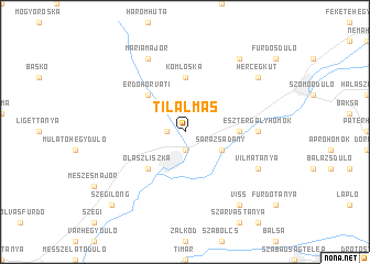
Tilalmas (Borsod-Abaúj-Zemplén, Hungary)Tilalmas is a town in the Borsod-Abaúj-Zemplén region of Hungary. An overview map of the region around Tilalmas is displayed below.
regional and 3d topo map of Tilalmas, Hungary ::
Tilalmas airports ::
The nearest airport is KSC - Kosice, located 45.4 km north of Tilalmas.
Other airports nearby include DEB - Debrecen (89.0 km south), SUJ - Satu Mare (124.0 km south east), TAT - Poprad Tatry (126.0 km north west), OMR - Oradea (143.7 km south), Nearby towns ::
Vámosújfalu (1.9km south) //
Tolcsva (1.2km west) //
Nagytanya (1.2km west) //
Sárazsadány (3.1km south east) //
Olaszliszka (4.5km south west) //
Erdőhorváti (4.5km north west) //
Bodrogolaszi (3.7km east) //
Komlóska (5.6km north) //
Esztergályhomok (4.9km east) //
Törökér (6.2km south east) //
Vilmatanya (6.2km south east) //
Törökértanya (6.2km south east) //
Máriamajor (7.8km north) //
Hercegkút (7.4km north east) //
Viss (8.3km south east) //
Makkoshotyka (8.3km north east) //
Szegilong (8.9km south west) //
[all distances 'as the bird flies' and approximate]  Places with similar names to Tilalmas, Hungary ::
// Dealu Lămoşoi (RO)
// Tilalmoş (RO)
Disclaimer :: Information on this page comes without warranty of any kind |
||
|
Where is Tilalmas? Elevation and coordinates ::
Latitude (lat): 48°17'0"N Longitude (lon): 21°28'0"E
Elevation (approx.): 157m (map arrows pan, magnifying glasses zoom) |
||
|
Visiting Tilalmas? Hotel/Accommodation ::
Book a hotel in Tilalmas Travel Guide ::
Buy a travel guide for Hungary rental cars ::
car rental offers GPS waypoint ::
download a GPX waypoint (PoI) of Tilalmas for your GPS receiver
|
||