|
search place name
|
||
Tótújfalu (Somogy, Hungary)Tótújfalu is a town in the Somogy region of Hungary. An overview map of the region around Tótújfalu is displayed below.
regional and 3d topo map of Tótújfalu, Hungary ::

Tótújfalu airports ::
The nearest airport is OSI - Osijek, located 102.2 km south east of Tótújfalu.
Other airports nearby include ZAG - Zagreb (124.5 km west), MBX - Maribor (165.2 km north west), BUD - Budapest Ferihegy (210.2 km north east), Nearby towns ::
Szentborbás (2.0km south east) //
Potonypuszta (2.1km north east) //
Lakócsa (2.2km east) //
Potony (3.6km north) //
Bagópuszta (5.7km north) //
Stari Budakovac (5.8km south) //
Novi Budakovac (5.8km south) //
Lanka Leševo (4.3km west) //
Detkovac (4.8km west) //
Drávagárdony (6.4km north west) //
Felsőszentmárton (6.3km south east) //
Zádor (7.5km north) //
Faluvég (7.5km north) //
Zádorimalom (7.5km north) //
Kastélyosdombó (6.9km north west) //
Szörény (7.8km north) //
Sokolac Podravski (7.1km south west) //
Kétújfalu (8.4km north east) //
Vitézipuszta (7.1km north east) //
Gaćište (8.5km south west) //
Teklafalu (8.2km north east) //
Szentmihályfapuszta (9.6km north east) //
[all distances 'as the bird flies' and approximate] 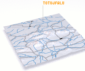 Places with similar names to Tótújfalu, Hungary ::
// Tótújfalu (HU)
Disclaimer :: Information on this page comes without warranty of any kind |
||
|
Where is Tótújfalu? Elevation and coordinates ::
Latitude (lat): 45°53'58"N Longitude (lon): 17°39'20"E
Elevation (approx.): 102m (map arrows pan, magnifying glasses zoom) |
||
|
Visiting Tótújfalu? Hotel/Accommodation ::
Book a hotel in Tótújfalu Travel Guide ::
Buy a travel guide for Hungary rental cars ::
car rental offers GPS waypoint ::
download a GPX waypoint (PoI) of Tótújfalu for your GPS receiver
|
||