|
search place name
|
||
Bukit Panjang Estate (Singapore)Bukit Panjang Estate is a town in Singapore. An overview map of the region around Bukit Panjang Estate is displayed below.
regional and 3d topo map of Bukit Panjang Estate, Singapore ::

Bukit Panjang Estate airports ::
The nearest airport is XSP - Singapore Seletar, located 13.4 km east of Bukit Panjang Estate.
Other airports nearby include QPG - Paya Lebar (17.6 km east), SIN - Singapore Changi Intl (27.1 km east), JHB - Johor Bahru Sultan Ismail (30.2 km north), MKZ - Malacca (193.4 km north west), Nearby towns ::
Choa Chu Kang New Town (0.3km west) //
Kampong Bukit Panjang (0.9km east) //
Keat Hong Village (1.0km south west) //
Bukit Panjang New Town (1.4km east) //
Yew Tee (1.4km north) //
Kampong Cutforth (1.8km west) //
Princess Elizabeth Estate (2.3km south) //
Lam San Village (2.4km west) //
Bamboo Grove Park (2.7km south) //
Aik Hong and Aik Chiang Estate (2.8km west) //
Fuyong Estate (3.0km south east) //
Hume Heights (3.3km south east) //
Bukit Mandai Village (3.4km north) //
Bukit Batok New Town (3.5km south) //
Teck Chong Estate (3.9km north) //
Kampong Sungai Jurong (3.9km south west) //
Bulim (3.9km west) //
Kian Hong Estate (4.0km south west) //
Kampong Ulu Pandan (4.0km south) //
Hong Kah (4.1km south west) //
Sungai Mandai Village (4.2km north east) //
Jurong East New Town (4.7km south) //
Jurong West New Town (4.8km south west) //
Bukit Timah Estate (5.3km south east) //
Kampong Chantek Baharu (5.3km south east) //
Eng Khong Gardens (5.4km south) //
Tengah (5.5km west) //
Marsiling Estate (5.6km north) //
Kilburn Estate (5.6km south east) //
[all distances 'as the bird flies' and approximate] 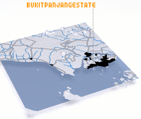 Places with similar names to Bukit Panjang Estate, Singapore :: Disclaimer :: Information on this page comes without warranty of any kind |
||
|
Where is Bukit Panjang Estate? Elevation and coordinates ::
Latitude (lat): 1°22'54"N Longitude (lon): 103°45'9"E
Elevation (approx.): 27m (map arrows pan, magnifying glasses zoom) |
||
|
Visiting Bukit Panjang Estate? Hotel/Accommodation ::
Book a hotel in Bukit Panjang Estate Travel Guide ::
Buy a travel guide for Singapore rental cars ::
car rental offers GPS waypoint ::
download a GPX waypoint (PoI) of Bukit Panjang Estate for your GPS receiver
|
||