|
search place name
|
||
Gaubiai (Lithuania)Gaubiai is a town in Lithuania. An overview map of the region around Gaubiai is displayed below.
regional and 3d topo map of Gaubiai, Lithuania ::
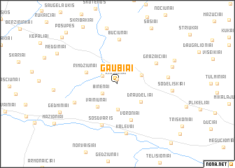
Nearby towns ::
Rimšoniai (0.8km north) //
Peluodžiai (1.8km north west) //
Binėnai (2.0km south west) //
Starkoniai (4.0km south) //
Pašvitinys (2.6km north east) //
Draudeliai (3.5km south east) //
Vainiūnai (4.1km south west) //
Rimdžiūnai (3.3km north west) //
Voroniai (5.9km south) //
Sosdvaris (6.7km south) //
Gražaičiai (4.8km north east) //
Bučiūnai (7.1km north) //
Mikniūnai (4.8km south west) //
Kalevai (7.9km south) //
Peleniškiai (4.6km east) //
Sodeliškiai (5.0km east) //
Mišeikiai (8.9km north) //
Laitiešiniai (5.5km north east) //
Šašiai (9.4km north) //
Stoniūnai (8.9km north west) //
Pošupės (9.4km north west) //
[all distances 'as the bird flies' and approximate] 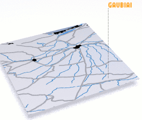 Places with similar names to Gaubiai, Lithuania ::
Disclaimer :: Information on this page comes without warranty of any kind |
||
|
Where is Gaubiai? Elevation and coordinates ::
Latitude (lat): 56°8'50"N Longitude (lon): 23°46'52"E
Elevation (approx.): 54m (map arrows pan, magnifying glasses zoom) |
||
|
Visiting Gaubiai? Hotel/Accommodation ::
Book a hotel in Gaubiai Travel Guide ::
Buy a travel guide for Lithuania rental cars ::
car rental offers GPS waypoint ::
download a GPX waypoint (PoI) of Gaubiai for your GPS receiver
|
||