|
search place name
|
||
Ivangėnai (Lithuania)Ivangėnai is a town in Lithuania. An overview map of the region around Ivangėnai is displayed below.
regional and 3d topo map of Ivangėnai, Lithuania ::

Nearby towns ::
Skaudvilė (1.1km west) //
Pasuvirkštis (1.9km north) //
Pauliškiai (1.9km south) //
Šidagiai (1.8km south west) //
Būteniai (1.9km north east) //
Karšuva (2.1km west) //
Kavadoniai (3.7km north) //
Adakavas (2.5km south east) //
Nosaičiai (4.3km south west) //
Šiurpiškė (4.3km south west) //
Barsukynė (5.6km south) //
Bokšeiniai (3.2km east) //
Skaudvilė (3.3km west) //
Pavėriai (5.7km north) //
Daujotėliai (3.7km north east) //
Keteriai (3.7km north west) //
Kirkliai (5.7km north) //
Papušyniai (3.7km south east) //
Kryžkalnis (4.9km north east) //
Simėnai (4.9km north west) //
Jakštai (4.2km west) //
Petkaičiai (7.4km south) //
Kundročiai (4.6km south west) //
Lygiai (4.6km north east) //
Būkintlaukis (7.5km south) //
Očiki (4.6km south east) //
Bardžiai (7.7km north) //
Pastulgiai (7.7km north) //
Varlaukis (7.7km south) //
[all distances 'as the bird flies' and approximate] 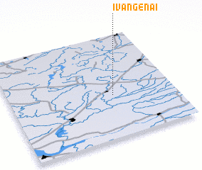 Places with similar names to Ivangėnai, Lithuania :: Disclaimer :: Information on this page comes without warranty of any kind |
||
|
Where is Ivangėnai? Elevation and coordinates ::
Latitude (lat): 55°25'0"N Longitude (lon): 22°38'0"E
Elevation (approx.): 106m (map arrows pan, magnifying glasses zoom) |
||
|
Visiting Ivangėnai? Hotel/Accommodation ::
Book a hotel in Ivangėnai Travel Guide ::
Buy a travel guide for Lithuania rental cars ::
car rental offers GPS waypoint ::
download a GPX waypoint (PoI) of Ivangėnai for your GPS receiver
|
||