|
search place name
|
||
Mištautai (Lithuania)Mištautai is a town in Lithuania. An overview map of the region around Mištautai is displayed below.
regional and 3d topo map of Mištautai, Lithuania ::

Nearby towns ::
Lipliūnai (1.7km south west) //
Urnėžiai (2.1km north east) //
Šiukštuliškiai (2.6km south west) //
Kėboniai (2.4km south east) //
Dotnuva (3.9km north) //
(( Šingaliai )) (3.8km south) //
Tubiai (3.2km south east) //
(( Pūstelninkai )) (4.3km south west) //
Keleriškiai (4.6km south east) //
Kropilai (3.5km east) //
Adomiškiai (5.7km north) //
(( Bartkūniškiai )) (3.7km south west) //
Ąžuolaičiai (3.7km north west) //
Novočėbė (5.5km south) //
Šingaliai (6.8km south) //
(( Varkaliai )) (4.2km east) //
Gėlainiai (7.5km north) //
Močėnai (6.4km north east) //
Valučiai (6.4km north west) //
Janušava (5.2km south east) //
Daškoniai (5.6km north east) //
Mantviloniai (7.5km south east) //
Ramėnai (8.1km north east) //
Josvainiai (8.0km south west) //
Čiukiškiai (7.2km south west) //
Juodkaimiai (9.1km south west) //
Pelėdnagiai (8.9km south east) //
[all distances 'as the bird flies' and approximate] 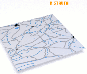 Places with similar names to Mištautai, Lithuania ::
Disclaimer :: Information on this page comes without warranty of any kind |
||
|
Where is Mištautai? Elevation and coordinates ::
Latitude (lat): 55°18'59"N Longitude (lon): 23°53'2"E
Elevation (approx.): 51m (map arrows pan, magnifying glasses zoom) |
||
|
Visiting Mištautai? Hotel/Accommodation ::
Book a hotel in Mištautai Travel Guide ::
Buy a travel guide for Lithuania rental cars ::
car rental offers GPS waypoint ::
download a GPX waypoint (PoI) of Mištautai for your GPS receiver
|
||