|
search place name
|
||
Parudaminys (Lithuania)Parudaminys is a town in Lithuania. An overview map of the region around Parudaminys is displayed below.
regional and 3d topo map of Parudaminys, Lithuania ::
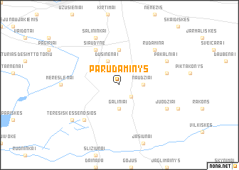
Nearby towns ::
Marijampolė (2.1km south east) //
Naudžiai (2.2km east) //
Galiniai (3.7km south) //
Dusinėnai (3.9km north) //
Kalviškės (5.6km north) //
Juodšiliai (6.0km north) //
Siaudyne (6.0km north) //
Daržininkai (4.7km north east) //
Čekėnai (6.4km north east) //
Rudamina (6.4km north east) //
Terešiškės (6.4km south west) //
Salininkai (7.7km north) //
Juodžiai (5.7km south east) //
Pakalniai (5.7km north east) //
Terešiškės Senosios (7.0km south west) //
[all distances 'as the bird flies' and approximate]  Places with similar names to Parudaminys, Lithuania ::
// Porto Manso (PT)
// Porto Moniz (PT)
// Pār Dāmnās (BD)
// Puerto Miniso (MX)
// Pará de Minas (BR)
// Pré de Mians (FR)
Disclaimer :: Information on this page comes without warranty of any kind |
||
|
Where is Parudaminys? Elevation and coordinates ::
Latitude (lat): 54°32'0"N Longitude (lon): 25°18'0"E
Elevation (approx.): 154m (map arrows pan, magnifying glasses zoom) |
||
|
Visiting Parudaminys? Hotel/Accommodation ::
Book a hotel in Parudaminys Travel Guide ::
Buy a travel guide for Lithuania rental cars ::
car rental offers GPS waypoint ::
download a GPX waypoint (PoI) of Parudaminys for your GPS receiver
|
||