|
search place name
|
||
Stabaunyčius (Lithuania)Stabaunyčius is a town in Lithuania. An overview map of the region around Stabaunyčius is displayed below.
regional and 3d topo map of Stabaunyčius, Lithuania ::
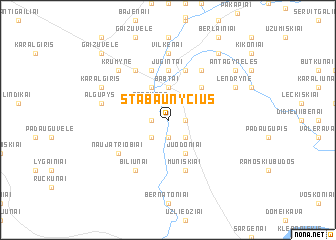
Nearby towns ::
Šašiai (1.1km east) //
Gailiušiai (1.1km east) //
Eglynai (1.1km west) //
Sitkūnai (1.9km south) //
Babtynas (2.1km north west) //
Sitkūnai II (2.1km south east) //
Vošiškiai (2.1km south west) //
Babtai (3.7km north) //
Piepaliai (2.8km north west) //
Varekoniai (3.9km north) //
Juodoniai (3.9km south) //
Antaginė (4.3km north east) //
Jugintai (5.6km north) //
Muniškiai (5.7km south) //
Vandžiogala (5.7km north) //
Bukolainia (5.7km north) //
Kaniūkai (5.7km north) //
Biliūnai (6.0km south) //
Pagynė (6.0km north) //
Gaižuvėlė-Pastriūnė (6.0km north) //
Naujatriobiai (4.9km south west) //
Vilkėnai (7.4km north) //
Panevėžiukas (7.4km north) //
Algupys (4.6km north west) //
Krūmyne (6.4km north west) //
Lendrynė (5.6km north east) //
Karalgiris (5.6km north west) //
Urnėžiai (8.1km north east) //
Antagynėlės (7.0km north east) //
[all distances 'as the bird flies' and approximate] 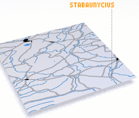 Places with similar names to Stabaunyčius, Lithuania :: Disclaimer :: Information on this page comes without warranty of any kind |
||
|
Where is Stabaunyčius? Elevation and coordinates ::
Latitude (lat): 55°4'0"N Longitude (lon): 23°48'0"E
Elevation (approx.): 44m (map arrows pan, magnifying glasses zoom) |
||
|
Visiting Stabaunyčius? Hotel/Accommodation ::
Book a hotel in Stabaunyčius Travel Guide ::
Buy a travel guide for Lithuania rental cars ::
car rental offers GPS waypoint ::
download a GPX waypoint (PoI) of Stabaunyčius for your GPS receiver
|
||