|
search place name
|
||
Tūmeliai (Lithuania)Tūmeliai is a town in Lithuania. An overview map of the region around Tūmeliai is displayed below.
regional and 3d topo map of Tūmeliai, Lithuania ::

Tūmeliai airports ::
The nearest airport is KGD - Kaliningrad Khrabrovo, located 84.4 km south west of Tūmeliai.
Nearby towns ::
Gurgždžiai (0.8km south) //
Kulėšai (2.2km north east) //
Užšustis (3.3km north) //
Pašyšiai (3.6km south) //
Kadagiškiai (3.9km north) //
Piktaičiai (2.9km south west) //
Metrikviečiai (3.1km north west) //
Tautiškiai (3.1km south east) //
Žemaičių Naumiestis (3.6km north east) //
Rimženčiai (5.4km north) //
Palendriai (3.4km east) //
Sugintai (3.5km east) //
Manklaukiai (6.2km south) //
Skėriai (6.1km south) //
Užlaukė (6.9km north) //
Rumšai (4.0km west) //
Laudžiai (4.3km west) //
Bartininkai II (6.1km north west) //
Tarvydai (4.9km south west) //
Cipariai (5.7km north east) //
Meišlaukiai (6.5km south east) //
Gardamas (7.9km north) //
Budrikai (4.9km north east) //
Vaitkaičiai (7.8km south) //
Laučiai (5.0km west) //
Raugeliai (5.9km south east) //
Kavoliai (7.9km south) //
Bartininkai I (7.7km north west) //
Mineikiai (5.4km west) //
[all distances 'as the bird flies' and approximate] 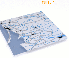 Places with similar names to Tūmeliai, Lithuania ::
Disclaimer :: Information on this page comes without warranty of any kind |
||
|
Where is Tūmeliai? Elevation and coordinates ::
Latitude (lat): 55°20'7"N Longitude (lon): 21°39'46"E
Elevation (approx.): 19m (map arrows pan, magnifying glasses zoom) |
||
|
Visiting Tūmeliai? Hotel/Accommodation ::
Book a hotel in Tūmeliai Travel Guide ::
Buy a travel guide for Lithuania rental cars ::
car rental offers GPS waypoint ::
download a GPX waypoint (PoI) of Tūmeliai for your GPS receiver
|
||