|
search place name
|
||
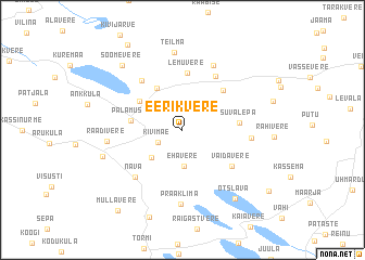
Eerikvere (Jõgevamaa, Estonia)Eerikvere is a town in the Jõgevamaa region of Estonia. An overview map of the region around Eerikvere is displayed below.
regional and 3d topo map of Eerikvere, Estonia ::
Eerikvere airports ::
The nearest airport is TLL - Tallinn-ulemiste International Tallinn, located 131.6 km north west of Eerikvere.
Other airports nearby include HEM - Helsinki Malmi (197.4 km north west), HEL - Helsinki Vantaa (205.6 km north west), Nearby towns ::
Kivimäe (1.8km south west) //
Ehavere (3.7km south) //
Luua (3.3km south west) //
Toovere (4.5km north) //
Palamuse (2.9km west) //
Järvepera (3.8km north west) //
Lemuvere (5.8km north) //
Varbevere (4.6km north east) //
Süvalepa (3.1km east) //
Vaidavere (4.6km south east) //
Ronivere (5.8km north) //
Koduküla (5.6km north west) //
Nava (5.5km south west) //
Kudina (3.8km east) //
Imukvere (6.9km north) //
Praaklima (7.7km south) //
Raadivere (4.2km west) //
Teilma (8.0km north) //
Pikkjärve (5.1km south west) //
Otslava (7.6km south) //
Soomevere (7.4km north west) //
Kaude (9.3km north) //
Mullavere (9.1km south) //
Kõrenduse (7.8km south east) //
[all distances 'as the bird flies' and approximate] 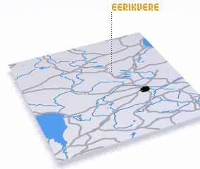 Places with similar names to Eerikvere, Estonia :: Disclaimer :: Information on this page comes without warranty of any kind |
||
|
Where is Eerikvere? Elevation and coordinates ::
Latitude (lat): 58°40'36"N Longitude (lon): 26°37'34"E
Elevation (approx.): 99m (map arrows pan, magnifying glasses zoom) |
||
|
Visiting Eerikvere? Hotel/Accommodation ::
Book a hotel in Eerikvere Travel Guide ::
Buy a travel guide for Estonia rental cars ::
car rental offers GPS waypoint ::
download a GPX waypoint (PoI) of Eerikvere for your GPS receiver
|
||