|
search place name
|
||
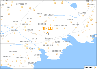
Kalli (Saaremaa, Estonia)Kalli is a town in the Saaremaa region of Estonia. An overview map of the region around Kalli is displayed below.
regional and 3d topo map of Kalli, Estonia ::
Kalli airports ::
The nearest airport is TLL - Tallinn-ulemiste International Tallinn, located 160.1 km north east of Kalli.
Nearby towns ::
Valayala (1.3km north west) //
Ure (1.3km north west) //
Uue-Lõve (2.7km south) //
Ure-Lilbi (2.9km north) //
Sakla (3.4km south) //
Kallemäe (3.3km south) //
Kogula (3.6km north) //
Veeriku (3.2km north) //
Kalju (2.4km north west) //
Tõnija (3.0km north east) //
Jursi (2.5km west) //
Sassi (4.8km north) //
Väljaküla (5.3km south) //
Nurme (4.4km south east) //
Koksi (5.4km north) //
Kuiste (5.5km north) //
Kase (3.9km south west) //
Silla (3.9km south west) //
Oessaare (6.3km south) //
Veneküla (6.6km north) //
Röösa (4.1km north east) //
Matsiranna (6.0km south) //
Ariste (3.7km west) //
Kõriska (6.8km north) //
Väkra (7.2km north) //
Rahu (5.3km north west) //
Siiksaare (7.7km south) //
Kungla (5.4km south east) //
Turja (6.5km south east) //
[all distances 'as the bird flies' and approximate] 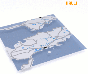 Places with similar names to Kalli, Estonia ::
Disclaimer :: Information on this page comes without warranty of any kind |
||
|
Where is Kalli? Elevation and coordinates ::
Latitude (lat): 58°23'27"N Longitude (lon): 22°52'52"E
Elevation (approx.): 12m (map arrows pan, magnifying glasses zoom) |
||
|
Visiting Kalli? Hotel/Accommodation ::
Book a hotel in Kalli Travel Guide ::
Buy a travel guide for Estonia rental cars ::
car rental offers GPS waypoint ::
download a GPX waypoint (PoI) of Kalli for your GPS receiver
|
||