|
search place name
|
||
Mäe-Vagula (Võrumaa, Estonia)Mäe-Vagula is a town in the Võrumaa region of Estonia. An overview map of the region around Mäe-Vagula is displayed below.
regional and 3d topo map of Mäe-Vagula, Estonia ::
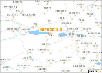
Nearby towns ::
Roosisaare (1.3km north) //
Ala-Vagula (1.0km west) //
Juba (1.4km south west) //
Võlsi (2.2km east) //
Käätso (3.8km south) //
Navi (4.9km north) //
Vana-Nursi (4.9km south) //
Nooska (6.1km south) //
Meeliku (5.4km south) //
Lompka (5.9km south) //
Soe (4.7km north west) //
Meegomäe (5.0km south east) //
Kirumpää (4.9km north east) //
Loosu (6.2km north) //
Vagula (5.0km north west) //
Võru (4.1km east) //
Raudsepa (5.4km south east) //
Võrumõisa (4.7km north east) //
Tagaküla (8.6km north) //
Parksepa (8.7km north) //
Otsa (6.8km south west) //
Väimela (7.6km north east) //
Nursi (7.6km south west) //
Mäe-Järvere (8.2km north west) //
Mõksi (9.2km south east) //
Mustahamba (9.1km south west) //
Kärnamäe (9.0km north east) //
[all distances 'as the bird flies' and approximate] 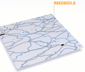 Places with similar names to Mäe-Vagula, Estonia ::
// Mfoukoualou (GA)
// M. Mafacale (MZ)
Disclaimer :: Information on this page comes without warranty of any kind |
||
|
Where is Mäe-Vagula? Elevation and coordinates ::
Latitude (lat): 57°50'0"N Longitude (lon): 26°57'0"E
Elevation (approx.): 85m (map arrows pan, magnifying glasses zoom) |
||
|
Visiting Mäe-Vagula? Hotel/Accommodation ::
Book a hotel in Mäe-Vagula Travel Guide ::
Buy a travel guide for Estonia rental cars ::
car rental offers GPS waypoint ::
download a GPX waypoint (PoI) of Mäe-Vagula for your GPS receiver
|
||