|
search place name
|
||
Oola (Raplamaa, Estonia)Oola is a town in the Raplamaa region of Estonia. An overview map of the region around Oola is displayed below.
regional and 3d topo map of Oola, Estonia ::

Oola airports ::
The nearest airport is TLL - Tallinn-ulemiste International Tallinn, located 40.8 km north of Oola.
Other airports nearby include HEM - Helsinki Malmi (134.7 km north), HEL - Helsinki Vantaa (141.4 km north), Nearby towns ::
Nõmme (1.2km west) //
Maidla (1.3km north east) //
Aranküla (2.3km south west) //
Purila-Eestjõe (4.0km north) //
Hõreda (3.2km south east) //
Vankse (4.3km north) //
Pae (4.8km south) //
Helda (3.1km south east) //
Ridaküla (3.9km south west) //
Juuru-Saunaküla (2.9km east) //
Purila-Ülejõe (3.5km north west) //
Purila (4.6km north west) //
Härgla (6.2km north) //
Ülejõe (5.3km south) //
Mõisaküla (6.1km north) //
Saaremõisa (7.0km north) //
Kalda (7.2km north) //
Orguse-Saunaküla (3.9km east) //
Hagudi (4.5km north west) //
Orguse (4.0km east) //
Juuru (4.3km north east) //
Seli (6.0km north west) //
Ingliste (5.0km south east) //
Lõiuse (8.3km north) //
Hertu (8.3km south) //
Uusküla (5.2km south west) //
Valtu (7.9km south) //
Vaksali (7.8km south) //
Sadala (8.3km north) //
[all distances 'as the bird flies' and approximate] 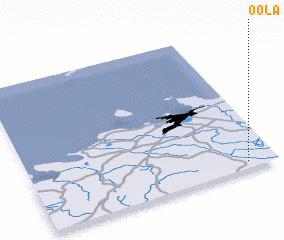 Places with similar names to Oola, Estonia ::
Disclaimer :: Information on this page comes without warranty of any kind |
||
|
Where is Oola? Elevation and coordinates ::
Latitude (lat): 59°2'54"N Longitude (lon): 24°52'56"E
Elevation (approx.): 67m (map arrows pan, magnifying glasses zoom) |
||
|
Visiting Oola? Hotel/Accommodation ::
Book a hotel in Oola Travel Guide ::
Buy a travel guide for Estonia rental cars ::
car rental offers GPS waypoint ::
download a GPX waypoint (PoI) of Oola for your GPS receiver
|
||