|
search place name
|
||
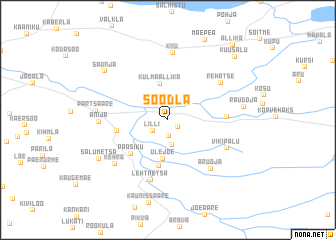
Soodla (Harjumaa, Estonia)Soodla is a town in the Harjumaa region of Estonia. An overview map of the region around Soodla is displayed below.
regional and 3d topo map of Soodla, Estonia ::
Soodla airports ::
The nearest airport is TLL - Tallinn-ulemiste International Tallinn, located 31.0 km west of Soodla.
Other airports nearby include HEM - Helsinki Malmi (99.2 km north), HEL - Helsinki Vantaa (106.9 km north), QVY - Utti (189.9 km north east), Nearby towns ::
Pirga (1.0km south east) //
Pirsu (1.8km south) //
Lilli (1.5km south west) //
Looküla (2.9km south) //
Külmaallika (4.1km north) //
Ülejõe (4.3km south) //
Ojaküla (5.2km south) //
Paasiku (4.3km south west) //
Kuusemäe (3.2km west) //
Kõrve Üks (3.4km east) //
Lehtmetsa (6.8km south) //
Aruoja (6.0km south east) //
Rehatse (5.1km north east) //
Vikipalu (4.6km south east) //
Kiiu (7.5km north) //
Anija (3.9km west) //
Kehra (5.8km south west) //
Partsaare (4.2km west) //
Raudoja (4.6km east) //
Salumetsa (5.8km south west) //
Saunja (6.5km north west) //
Kuusalu (8.0km north east) //
Allika (9.1km north east) //
[all distances 'as the bird flies' and approximate] 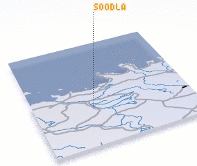 Places with similar names to Soodla, Estonia ::
Disclaimer :: Information on this page comes without warranty of any kind |
||
|
Where is Soodla? Elevation and coordinates ::
Latitude (lat): 59°22'49"N Longitude (lon): 25°22'28"E
Elevation (approx.): 53m (map arrows pan, magnifying glasses zoom) |
||
|
Visiting Soodla? Hotel/Accommodation ::
Book a hotel in Soodla Travel Guide ::
Buy a travel guide for Estonia rental cars ::
car rental offers GPS waypoint ::
download a GPX waypoint (PoI) of Soodla for your GPS receiver
|
||