|
search place name
|
||
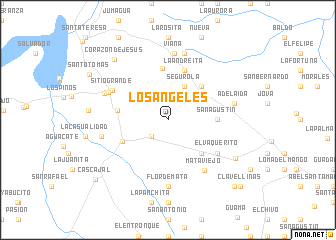
Los Ángeles (Villa Clara, Cuba)Los Ángeles is a town in the Villa Clara region of Cuba. An overview map of the region around Los Ángeles is displayed below.
regional and 3d topo map of Los Ángeles, Cuba ::
Los Ángeles airports ::
The nearest airport is SNU - Santa Clara Abel Santamaria, located 20.2 km south of Los Ángeles.
Other airports nearby include CFG - Cienfuegos Jaime Gonzalez (71.4 km south west), AVI - Ciego De Avila Maximo Gomez (143.4 km south east), VRA - Varadero Juan Gualberto Gomez Intl (152.8 km west), CYO - Cayo Vilo Acuna Intl (197.4 km south west), Nearby towns ::
Dos Ríos (2.5km south west) //
Unidad Proletaria (2.7km north west) //
Bella Vista (3.7km north west) //
Cuartel Guayabo (3.8km north east) //
Segurola (4.1km north east) //
Maribona (4.1km north east) //
San Andrés (5.0km north east) //
La Panchita (5.0km north east) //
San Sebastián (5.0km south east) //
Silencio (5.0km south east) //
Guayabo Viejo (5.1km east) //
San Agustín (5.1km east) //
Cifuentes (5.3km south west) //
San Pedro (5.7km north) //
La Duda (5.3km west) //
La Andreíta (5.8km north) //
Linares (6.3km south east) //
Palma Sola (6.3km south east) //
San Antonio (6.3km south east) //
El Vaquerito (6.3km south east) //
Mata Viejo (6.7km south east) //
Sitio Grande (6.6km north west) //
Santo Tomás (6.9km north west) //
Flor de Mata (7.4km south) //
Viana (7.4km north) //
Las Minas (7.6km north) //
Adelaida (7.1km east) //
Calonge (7.1km west) //
San José (7.2km north west) //
[all distances 'as the bird flies' and approximate] 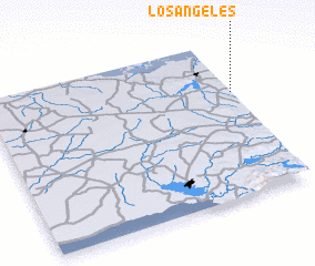 Places with similar names to Los Ángeles, Cuba ::
// Los Angeles (PH)
// Los Angeles (PH)
// Los Angeles (US)
// Los Ángeles (PA)
// Los Ángeles (PA)
// Los Ángeles (PA)
// Los Ángeles (CU)
// Los Ángeles (CU)
// Los Ángeles (CU)
// Los Ángeles (CU)
Disclaimer :: Information on this page comes without warranty of any kind |
||
|
Where is Los Ángeles? Elevation and coordinates ::
Latitude (lat): 22°40'0"N Longitude (lon): 80°0'0"W
Elevation (approx.): 136m (map arrows pan, magnifying glasses zoom) |
||
|
Visiting Los Ángeles? Hotel/Accommodation ::
Book a hotel in Los Ángeles Travel Guide ::
Buy a travel guide for Cuba rental cars ::
car rental offers GPS waypoint ::
download a GPX waypoint (PoI) of Los Ángeles for your GPS receiver
|
||