|
search place name
|
||
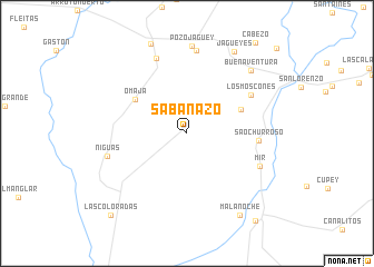
Sabanazo (Holguín, Cuba)Sabanazo is a town in the Holguín region of Cuba. An overview map of the region around Sabanazo is displayed below.
regional and 3d topo map of Sabanazo, Cuba ::
Sabanazo airports ::
The nearest airport is VTU - Las Tunas Hermanos Ameijeiras, located 31.8 km north west of Sabanazo.
Other airports nearby include HOG - Holguin Frank Pais Intl (39.9 km east), BYM - Bayamo Carlos Manuel De Cespedes (46.2 km south), MZO - Manzanillo Sierra Maestra (70.5 km south west), SCU - Santiago De Cuba Antonio Maceo Intl (129.2 km south east), Nearby towns ::
La Manteca (5.6km north east) //
Omaja (6.0km north west) //
Sao Churroso (6.8km east) //
Los Moscones (7.1km north east) //
Mir (7.5km south east) //
Los Coquitos (8.1km north) //
Niguas (7.8km west) //
La Caridad (8.4km north) //
Pozo Jagüey (8.8km north) //
Buenaventura (8.7km north east) //
Jagüeyes (9.4km north east) //
Mala Noche (9.6km south east) //
Monte Alto (10.9km south east) //
Las Coloradas (10.9km south west) //
[all distances 'as the bird flies' and approximate] 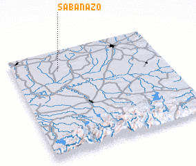 Places with similar names to Sabanazo, Cuba ::
Disclaimer :: Information on this page comes without warranty of any kind |
||
|
Where is Sabanazo? Elevation and coordinates ::
Latitude (lat): 20°48'27"N Longitude (lon): 76°41'51"W
Elevation (approx.): 68m (map arrows pan, magnifying glasses zoom) |
||
|
Visiting Sabanazo? Hotel/Accommodation ::
Book a hotel in Sabanazo Travel Guide ::
Buy a travel guide for Cuba rental cars ::
car rental offers GPS waypoint ::
download a GPX waypoint (PoI) of Sabanazo for your GPS receiver
|
||