|
search place name
|
||
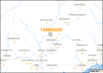
Tumbadero (Pinar del Río, Cuba)Tumbadero is a town in the Pinar del Río region of Cuba. An overview map of the region around Tumbadero is displayed below.
regional and 3d topo map of Tumbadero, Cuba ::
Tumbadero airports ::
The nearest airport is LCL - La Coloma, located 42.8 km east of Tumbadero.
Other airports nearby include GER - Nueva Gerona Rafael Cabrera (139.5 km east), HAV - Havana Jose Marti Intl (186.6 km north east), Nearby towns ::
San Miguel (1.9km east) //
San Miguel (2.4km south) //
Ciego (2.4km south) //
Regalo (2.4km south) //
San José (3.0km east) //
Gausas (4.3km south) //
Lacona (4.3km south) //
La Vieja (4.5km south east) //
Progreso (4.7km north east) //
El Colmenar (5.2km north) //
San Pedro (6.1km south) //
Calazán (6.1km south) //
Santa Rita (6.8km north east) //
Zarzal (7.0km south west) //
Punta de la Sierra (7.0km north east) //
Punta de la Sierra (7.2km north east) //
Guane (8.6km south west) //
Las Cañas (8.9km south west) //
[all distances 'as the bird flies' and approximate] 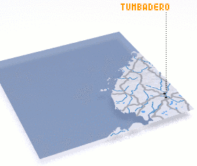 Places with similar names to Tumbadero, Cuba ::
Disclaimer :: Information on this page comes without warranty of any kind |
||
|
Where is Tumbadero? Elevation and coordinates ::
Latitude (lat): 22°16'19"N Longitude (lon): 84°3'5"W
Elevation (approx.): 73m (map arrows pan, magnifying glasses zoom) |
||
|
Visiting Tumbadero? Hotel/Accommodation ::
Book a hotel in Tumbadero Travel Guide ::
Buy a travel guide for Cuba rental cars ::
car rental offers GPS waypoint ::
download a GPX waypoint (PoI) of Tumbadero for your GPS receiver
|
||