|
search place name
|
||
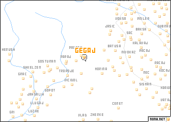
Gegaj (Kukës, Albania)Gegaj is a town in the Kukës region of Albania. An overview map of the region around Gegaj is displayed below.
regional and 3d topo map of Gegaj, Albania ::
Gegaj airports ::
The nearest airport is PRN - Pristina, located 70.2 km east of Gegaj.
Other airports nearby include TGD - Podgorica (78.7 km west), TIA - Tirana Rinas (119.9 km south), TIV - Tivat (121.8 km west), SKP - Skopje (128.3 km south east), Nearby towns ::
Lushaj (1.4km north west) //
(( Bukovë )) (1.6km west) //
Padesh (2.5km north west) //
Kasaj (2.8km south) //
Papaj (3.1km west) //
Buçaj (3.3km west) //
Morina (3.7km south east) //
Košare (3.8km north east) //
Potok Molić (3.6km east) //
Tropojë (4.3km south west) //
Viçidol (5.5km south west) //
Potok Morina (4.5km east) //
Pitamina e Poshtëme (6.1km south) //
Myhejan (4.8km west) //
Donja Morina (5.0km south east) //
Batuša (5.3km north east) //
Pitamina e Sipërme (6.9km south) //
Mejdan (6.6km south west) //
Molić (5.7km east) //
(( Hoxhaj )) (5.9km west) //
Ðocaj (7.1km north east) //
Bregu i Hođes (6.3km south east) //
Brovina (6.0km east) //
Shumicë-Ahmataj (6.7km south west) //
Kovaç (6.3km west) //
Gosturan (6.2km west) //
Goč (6.8km north east) //
Jasić (7.8km north east) //
Junik (7.8km north east) //
[all distances 'as the bird flies' and approximate] 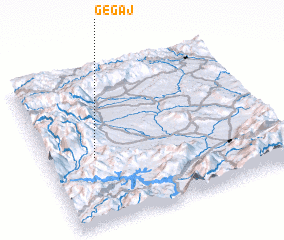 Places with similar names to Gegaj, Albania ::
Disclaimer :: Information on this page comes without warranty of any kind |
||
|
Where is Gegaj? Elevation and coordinates ::
Latitude (lat): 42°25'57"N Longitude (lon): 20°12'9"E
Elevation (approx.): 901m (map arrows pan, magnifying glasses zoom) |
||
|
Visiting Gegaj? Hotel/Accommodation ::
Book a hotel in Gegaj Travel Guide ::
Buy a travel guide for Albania rental cars ::
car rental offers GPS waypoint ::
download a GPX waypoint (PoI) of Gegaj for your GPS receiver
|
||