|
search place name
|
||
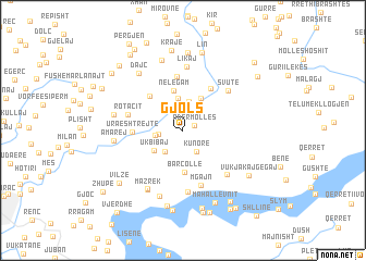
Gjols (Shkodër, Albania)Gjols is a town in the Shkodër region of Albania. An overview map of the region around Gjols is displayed below.
regional and 3d topo map of Gjols, Albania ::
Gjols airports ::
The nearest airport is TGD - Podgorica, located 43.8 km north west of Gjols.
Other airports nearby include TIA - Tirana Rinas (80.9 km south), TIV - Tivat (85.2 km west), PRN - Pristina (120.4 km north east), DBV - Dubrovnik (126.4 km west), Nearby towns ::
Ndërmollës (1.0km north east) //
Lumë (2.5km north) //
Vukjakaj-Gegaj (1.9km west) //
Kunorë (2.4km south east) //
Bjeshkʼ e Bregut (2.2km west) //
Sbuc (2.6km south west) //
Logjas (3.0km north) //
Nemas (3.3km north) //
Ukbibaj (3.0km south west) //
Dacaj (3.6km north) //
Nelegam (4.1km north) //
Barcollë (4.3km south) //
Lejthizëj (4.3km north west) //
Prekal (4.8km north east) //
Ura e Shtrejtë (3.9km west) //
Ashtʼ e Likajt (5.5km north) //
Rotacit (4.5km west) //
Mgajn (5.8km south) //
Svutë (5.3km north east) //
Krua i Madh (5.6km south east) //
Malas (6.4km south) //
Likaj (6.5km north) //
Mahallʼ e Dervishajt (6.6km south west) //
Mazrek (6.6km south west) //
Shpor (7.0km south) //
Amarej (5.4km west) //
Rekal (5.5km west) //
Dajç (6.8km north west) //
Cinlit (7.4km north) //
[all distances 'as the bird flies' and approximate]  Places with similar names to Gjols, Albania ::
Disclaimer :: Information on this page comes without warranty of any kind |
||
|
Where is Gjols? Elevation and coordinates ::
Latitude (lat): 42°8'33"N Longitude (lon): 19°41'40"E
Elevation (approx.): 895m (map arrows pan, magnifying glasses zoom) |
||
|
Visiting Gjols? Hotel/Accommodation ::
Book a hotel in Gjols Travel Guide ::
Buy a travel guide for Albania rental cars ::
car rental offers GPS waypoint ::
download a GPX waypoint (PoI) of Gjols for your GPS receiver
|
||