|
search place name
|
||
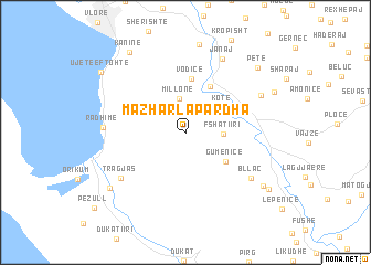
Mazhar-Lapardha (Vlorë, Albania)Mazhar-Lapardha is a town in the Vlorë region of Albania. An overview map of the region around Mazhar-Lapardha is displayed below.
regional and 3d topo map of Mazhar-Lapardha, Albania ::
Mazhar-Lapardha airports ::
The nearest airport is CFU - Kerkyra/corfu Ioannis Kapodistrias Intl, located 89.8 km south of Mazhar-Lapardha.
Other airports nearby include TIA - Tirana Rinas (117.1 km north), LCC - Lecce (122.9 km west), IOA - Ioannina (130.3 km south east), OHD - Ohrid (134.0 km north east), Nearby towns ::
Lapardha (2.4km north west) //
(( Millonë )) (3.5km north) //
Fshati i Ri (2.9km east) //
Kotë (3.7km north east) //
Gumenicë (4.2km south east) //
Mavrovë (5.0km north) //
Vodicë (5.5km north) //
Bllac (6.8km south east) //
Tragjas (6.8km south west) //
Janaj (8.0km north) //
Radhimë (6.4km west) //
Shkallë Mavrovë (6.9km north east) //
Drashovicë (9.0km north) //
Vrist (8.0km south east) //
(( Luath )) (8.1km south west) //
Petë (8.5km north east) //
Kaninë (9.2km north west) //
Gjorm (8.5km south east) //
Ujete e Ftohte (9.0km north west) //
[all distances 'as the bird flies' and approximate]  Places with similar names to Mazhar-Lapardha, Albania :: Disclaimer :: Information on this page comes without warranty of any kind |
||
|
Where is Mazhar-Lapardha? Elevation and coordinates ::
Latitude (lat): 40°22'1"N Longitude (lon): 19°34'10"E
Elevation (approx.): 271m (map arrows pan, magnifying glasses zoom) |
||
|
Visiting Mazhar-Lapardha? Hotel/Accommodation ::
Book a hotel in Mazhar-Lapardha Travel Guide ::
Buy a travel guide for Albania rental cars ::
car rental offers GPS waypoint ::
download a GPX waypoint (PoI) of Mazhar-Lapardha for your GPS receiver
|
||