|
search place name
|
||
Shtikë (Korçë, Albania)Shtikë is a town in the Korçë region of Albania. An overview map of the region around Shtikë is displayed below.
regional and 3d topo map of Shtikë, Albania ::

Shtikë airports ::
The nearest airport is KSO - Kastoria Aristotelis, located 48.6 km east of Shtikë.
Other airports nearby include IOA - Ioannina (82.3 km south), OHD - Ohrid (83.1 km north), KZI - Kozani Filippos (97.5 km east), CFU - Kerkyra/corfu Ioannis Kapodistrias Intl (114.6 km south west), Nearby towns ::
Butkë (1.2km east) //
Milec (2.7km south east) //
Bezhan (2.5km south east) //
Skorovot (3.7km south) //
Mollas (3.0km west) //
Helmës (3.4km north west) //
Qinam (4.0km south) //
Kozel (4.2km north east) //
Kreshovë (4.6km south) //
Pepellash (4.9km north) //
Selenicë (5.0km south) //
Vodicë (6.1km south west) //
Floq (8.1km north) //
Starjë (8.3km south) //
Qafëzez (6.4km west) //
Bejkovë (8.6km south west) //
Roshanj (7.8km north west) //
Lëngëz (10.2km south west) //
[all distances 'as the bird flies' and approximate] 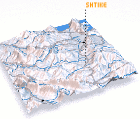 Places with similar names to Shtikë, Albania ::
// Shata Ga (MM)
// Shit-ka-aw (MM)
// Shitku (MM)
// Chetco (US)
// Chautauqua (US)
// Shattuc (US)
// Chautauqua (US)
// Chão de Gaia (PT)
// Chodak (PL)
// Chodaki (PL)
Disclaimer :: Information on this page comes without warranty of any kind |
||
|
Where is Shtikë? Elevation and coordinates ::
Latitude (lat): 40°25'56"N Longitude (lon): 20°42'33"E
Elevation (approx.): 1158m (map arrows pan, magnifying glasses zoom) |
||
|
Visiting Shtikë? Hotel/Accommodation ::
Book a hotel in Shtikë Travel Guide ::
Buy a travel guide for Albania rental cars ::
car rental offers GPS waypoint ::
download a GPX waypoint (PoI) of Shtikë for your GPS receiver
|
||