|
search place name
|
||
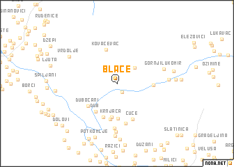
Blace (Bosnia and Herzegovina)Blace is a town in Bosnia and Herzegovina. An overview map of the region around Blace is displayed below.
regional and 3d topo map of Blace, Bosnia and Herzegovina ::
Blace airports ::
The nearest airport is SJJ - Sarajevo, located 28.9 km north east of Blace.
Other airports nearby include OMO - Mostar (43.1 km south west), DBV - Dubrovnik (117.9 km south), TIV - Tivat (143.4 km south), SPU - Split (147.2 km west), Nearby towns ::
Dugolaz (1.4km south) //
Čuhovići (3.2km north east) //
Krnjača (5.4km south) //
Gnjilica (5.5km south) //
Dub (5.1km south west) //
Kovačevac (5.6km north) //
Višnjevlje (4.2km east) //
Prebilje (5.6km south) //
Grušča (5.8km south) //
Dubočani (4.9km south west) //
Cuce (5.9km south) //
Bijela Kosa (6.5km south) //
Osoje (7.1km south) //
Gornje Njive (7.7km south) //
Gornji Lukomir (5.8km north east) //
Vadetina (6.0km east) //
Dudle (8.3km south) //
Vrdolje (7.1km north west) //
Blaca (8.9km south) //
Potkomlje (8.9km south) //
Kašići (9.4km south) //
Dolovi (9.2km south west) //
Šištica (9.6km south west) //
[all distances 'as the bird flies' and approximate]  Places with similar names to Blace, Bosnia and Herzegovina ::
Disclaimer :: Information on this page comes without warranty of any kind |
||
|
Where is Blace? Elevation and coordinates ::
Latitude (lat): 43°37'0"N Longitude (lon): 18°7'0"E
Elevation (approx.): 943m (map arrows pan, magnifying glasses zoom) |
||
|
Visiting Blace? Hotel/Accommodation ::
Book a hotel in Blace Travel Guide ::
rental cars ::
car rental offers GPS waypoint ::
download a GPX waypoint (PoI) of Blace for your GPS receiver
|
||