|
search place name
|
||
Draičevići (Federacija Bosne i Hercegovine, Bosnia and Herzegovina)Draičevići is a town in the Federacija Bosne i Hercegovine region of Bosnia and Herzegovina. An overview map of the region around Draičevići is displayed below.
regional and 3d topo map of Draičevići, Bosnia and Herzegovina ::

Draičevići airports ::
The nearest airport is SJJ - Sarajevo, located 42.7 km east of Draičevići.
Other airports nearby include OMO - Mostar (58.9 km south), SPU - Split (124.9 km west), DBV - Dubrovnik (144.0 km south), TIV - Tivat (173.4 km south east), Nearby towns ::
Here (0.4km south east) //
Baruni (1.1km south) //
Kruščica (0.9km south east) //
Han (1.0km south west) //
Solakova Kula (1.3km south) //
Mustafići (1.0km south east) //
Soljići (1.7km south) //
Gornji Čažanj (2.0km south east) //
Mutavdžije (2.2km south east) //
Majići (2.7km south) //
Crni Vrh (2.9km north) //
Kale (3.0km south) //
Krajkovići (2.9km south east) //
Baraci (3.3km south) //
Bušćak (3.4km south) //
Rajići (2.6km west) //
Plavuzi (3.3km north east) //
Ruste (2.8km north east) //
Hasani (3.0km south west) //
Tadići (2.9km east) //
Pandže (2.9km south west) //
Orlje (3.5km south east) //
Donji Čažanj (3.0km east) //
Lukšije (3.8km south east) //
Umčići (4.2km north) //
Bare (3.1km east) //
Lipovci (3.3km south east) //
Sudari (3.3km east) //
Parsovići (4.6km south) //
[all distances 'as the bird flies' and approximate] 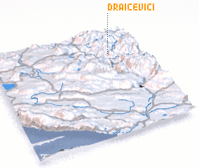 Places with similar names to Draičevići, Bosnia and Herzegovina ::
Disclaimer :: Information on this page comes without warranty of any kind |
||
|
Where is Draičevići? Elevation and coordinates ::
Latitude (lat): 43°48'42"N Longitude (lon): 17°48'2"E
Elevation (approx.): 1158m (map arrows pan, magnifying glasses zoom) |
||
|
Visiting Draičevići? Hotel/Accommodation ::
Book a hotel in Draičevići Travel Guide ::
rental cars ::
car rental offers GPS waypoint ::
download a GPX waypoint (PoI) of Draičevići for your GPS receiver
|
||