|
search place name
|
||
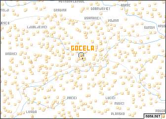
Gočela (Federacija Bosne i Hercegovine, Bosnia and Herzegovina)Gočela is a town in the Federacija Bosne i Hercegovine region of Bosnia and Herzegovina. An overview map of the region around Gočela is displayed below.
regional and 3d topo map of Gočela, Bosnia and Herzegovina ::
Gočela airports ::
The nearest airport is SJJ - Sarajevo, located 51.8 km north west of Gočela.
Other airports nearby include OMO - Mostar (95.9 km south west), DBV - Dubrovnik (131.5 km south west), TIV - Tivat (138.6 km south), TGD - Podgorica (145.1 km south), Nearby towns ::
Bare (0.1km south east) //
Kamen (0.3km east) //
Jagodići (0.4km north west) //
Kraljevac (0.5km north east) //
Lukarice (0.8km west) //
Ratkovići (1.3km south) //
Kamen (1.2km south east) //
Bogušići (1.1km west) //
Završje (1.6km north) //
Štita (1.4km south east) //
Pundol (1.9km north) //
Mirvići (2.0km north west) //
Mravnjac (2.0km south east) //
Brijeg (2.2km south) //
Drekali (1.7km east) //
Stupi (2.4km south) //
Vranići (2.3km south west) //
Potrkuša (2.6km south) //
Brezje (1.9km east) //
Kalac (2.0km south east) //
Odska (2.1km north west) //
Ahmovići (2.5km south east) //
Gornja Brda (2.3km north east) //
Batkovići (2.2km west) //
Džindići (3.0km south) //
Butkovići (2.3km west) //
Toholji (2.7km north west) //
Kolovarice (3.0km south west) //
Brišta (2.9km south east) //
[all distances 'as the bird flies' and approximate]  Places with similar names to Gočela, Bosnia and Herzegovina ::
Disclaimer :: Information on this page comes without warranty of any kind |
||
|
Where is Gočela? Elevation and coordinates ::
Latitude (lat): 43°38'36"N Longitude (lon): 18°55'24"E
Elevation (approx.): 555m (map arrows pan, magnifying glasses zoom) |
||
|
Visiting Gočela? Hotel/Accommodation ::
Book a hotel in Gočela Travel Guide ::
rental cars ::
car rental offers GPS waypoint ::
download a GPX waypoint (PoI) of Gočela for your GPS receiver
|
||