|
search place name
|
||
Karahodže (Federacija Bosne i Hercegovine, Bosnia and Herzegovina)Karahodže is a town in the Federacija Bosne i Hercegovine region of Bosnia and Herzegovina. An overview map of the region around Karahodže is displayed below.
regional and 3d topo map of Karahodže, Bosnia and Herzegovina ::

Karahodže airports ::
The nearest airport is SJJ - Sarajevo, located 63.3 km south east of Karahodže.
Other airports nearby include OMO - Mostar (103.9 km south), SPU - Split (139.3 km south west), OSI - Osijek (161.6 km north east), DBV - Dubrovnik (188.4 km south), Nearby towns ::
Zolote (0.6km north) //
Peštovići (0.8km south) //
Pokrajčići (1.1km south) //
Banovići (1.2km north west) //
Brajići (1.2km north east) //
Lovići (1.2km south west) //
Baje (1.4km north east) //
Čifluk (1.4km north west) //
Dolac (1.4km east) //
Šarići (1.9km north) //
Brankovac (1.5km west) //
Zabilje (2.1km south east) //
Ograde (2.3km south) //
Han-Bila (2.4km north) //
Kljaci (1.8km east) //
Vrbice (2.1km north east) //
Ričice (2.1km south west) //
Radojčići (2.5km north west) //
Sadovače (2.9km south) //
Orožine (2.4km north east) //
Nova Bila (2.9km south west) //
Kula (2.5km west) //
Džepine (2.4km west) //
Brajkovići (3.2km north east) //
Stara Bila (3.8km south) //
Brdo (3.1km south east) //
Sučići (3.1km south east) //
Krište (3.3km south east) //
Podovi (4.0km north) //
[all distances 'as the bird flies' and approximate] 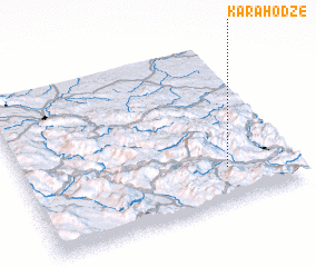 Places with similar names to Karahodže, Bosnia and Herzegovina ::
// Quarry Heights (US)
// Quarry Heights (PA)
// Carahatas (CU)
// Carey Heights (US)
// Coury Heights (US)
// Quarry Heights (US)
// Karr Heights (US)
Disclaimer :: Information on this page comes without warranty of any kind |
||
|
Where is Karahodže? Elevation and coordinates ::
Latitude (lat): 44°12'57"N Longitude (lon): 17°45'27"E
Elevation (approx.): 536m (map arrows pan, magnifying glasses zoom) |
||
|
Visiting Karahodže? Hotel/Accommodation ::
Book a hotel in Karahodže Travel Guide ::
rental cars ::
car rental offers GPS waypoint ::
download a GPX waypoint (PoI) of Karahodže for your GPS receiver
|
||