|
search place name
|
||
Kotor-Varoš (Republika Srpska, Bosnia and Herzegovina)Kotor-Varoš is a town in the Republika Srpska region of Bosnia and Herzegovina. An overview map of the region around Kotor-Varoš is displayed below.
regional and 3d topo map of Kotor-Varoš, Bosnia and Herzegovina ::

Kotor-Varoš airports ::
The nearest airport is SJJ - Sarajevo, located 116.8 km south east of Kotor-Varoš.
Other airports nearby include OSI - Osijek (147.2 km north east), SPU - Split (147.5 km south west), OMO - Mostar (153.0 km south), ZAG - Zagreb (161.7 km north west), Nearby towns ::
Donja Varoš (0.7km north) //
Kotor (0.8km south west) //
Kotorište (0.7km south east) //
Cepak (1.3km south east) //
Zagrađe (1.5km south west) //
Donja Slatina (1.8km north) //
Gornja Slatina (1.8km north east) //
Duratovci (1.8km west) //
Topolje (2.5km north) //
Mandići (2.9km north) //
Donja Baština (2.6km north east) //
Jasikovica (2.1km west) //
Matijevići (3.0km south) //
Srednje Brdo (3.2km south) //
Novo Selo (2.9km north west) //
Jurići (3.5km north) //
Sokoline (3.5km south) //
Plane (2.8km south east) //
Ravne (2.8km north west) //
Grgići (3.3km south west) //
Zabrđe (3.9km north) //
Grgići (3.9km south) //
Donje Postolje (3.8km south east) //
Svinjara (4.0km north) //
Vidovići (3.7km north west) //
Topolovići (4.2km north) //
Josipovići (4.4km north) //
Manovići (3.7km south west) //
Lazići (4.5km south) //
[all distances 'as the bird flies' and approximate] 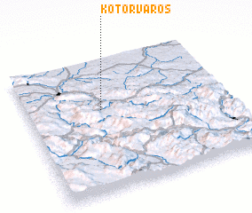 Places with similar names to Kotor-Varoš, Bosnia and Herzegovina :: Disclaimer :: Information on this page comes without warranty of any kind |
||
|
Where is Kotor-Varoš? Elevation and coordinates ::
Latitude (lat): 44°37'1"N Longitude (lon): 17°22'18"E
Elevation (approx.): 286m (map arrows pan, magnifying glasses zoom) |
||
|
Visiting Kotor-Varoš? Hotel/Accommodation ::
Book a hotel in Kotor-Varoš Travel Guide ::
rental cars ::
car rental offers GPS waypoint ::
download a GPX waypoint (PoI) of Kotor-Varoš for your GPS receiver
|
||