|
search place name
|
||
Kuta (Federacija Bosne i Hercegovine, Bosnia and Herzegovina)Kuta is a town in the Federacija Bosne i Hercegovine region of Bosnia and Herzegovina. An overview map of the region around Kuta is displayed below.
regional and 3d topo map of Kuta, Bosnia and Herzegovina ::

Kuta airports ::
The nearest airport is SJJ - Sarajevo, located 37.7 km north east of Kuta.
Other airports nearby include OMO - Mostar (41.0 km south), DBV - Dubrovnik (123.6 km south), SPU - Split (132.6 km west), TIV - Tivat (152.2 km south east), Nearby towns ::
Osijek (0.6km south east) //
Zovke (0.5km east) //
Zabrade (0.7km east) //
Zaslivlje (1.1km north) //
Bare (1.2km south) //
Andelići (1.3km north east) //
Petrovići (1.3km north west) //
Banovići (1.1km west) //
Burići (1.6km south) //
Turija (1.5km south east) //
Markovići (1.3km east) //
Bebeci (1.6km north west) //
Čatuša (2.2km south east) //
Pehari (2.4km south) //
Tuščica (2.0km east) //
Donje Selo (2.7km north) //
Vrelo (2.1km north west) //
Gredina (2.5km north east) //
Konjic (2.3km east) //
Orahovica (3.0km north west) //
Prevlje (2.9km south east) //
Cerići (3.6km north) //
Repovica (2.8km north east) //
Jurići (3.3km north east) //
Cagare (2.9km south east) //
Jošanica (3.4km south east) //
Sućešnica (3.8km south) //
Čovići (3.6km north east) //
Polje-Bijela (3.4km south east) //
[all distances 'as the bird flies' and approximate] 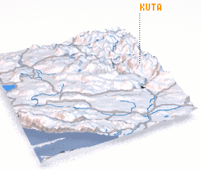 Places with similar names to Kuta, Bosnia and Herzegovina ::
Disclaimer :: Information on this page comes without warranty of any kind |
||
|
Where is Kuta? Elevation and coordinates ::
Latitude (lat): 43°38'47"N Longitude (lon): 17°56'2"E
Elevation (approx.): 546m (map arrows pan, magnifying glasses zoom) |
||
|
Visiting Kuta? Hotel/Accommodation ::
Book a hotel in Kuta Travel Guide ::
rental cars ::
car rental offers GPS waypoint ::
download a GPX waypoint (PoI) of Kuta for your GPS receiver
|
||