|
search place name
|
||
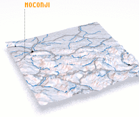
Moconji (Republika Srpska, Bosnia and Herzegovina)Moconji is a town in the Republika Srpska region of Bosnia and Herzegovina. An overview map of the region around Moconji is displayed below.
regional and 3d topo map of Moconji, Bosnia and Herzegovina ::

Moconji airports ::
The nearest airport is ZAG - Zagreb, located 137.5 km north west of Moconji.
Other airports nearby include SJJ - Sarajevo (141.6 km south east), SPU - Split (148.8 km south west), OSI - Osijek (156.1 km north east), ZAD - Zadar (156.9 km south west), Nearby towns ::
Koprene (0.8km north) //
Božići (0.9km west) //
Dukići (1.1km east) //
Pošalići (1.5km south west) //
Javorci (1.4km north east) //
Diljevići (1.8km south) //
Udovičići (1.7km south east) //
Ðurđevići (2.0km north west) //
Kola Donja (2.0km north east) //
Krčma (1.7km east) //
Mandići (2.4km south) //
Krečari (2.3km north east) //
Trubajići (2.5km south west) //
Galići (2.1km north west) //
Marići (2.5km north west) //
Gojići (3.0km north) //
Bukvalek (2.3km north east) //
Vukliševići (3.1km south) //
Bukvaluk (2.6km south east) //
Javorci (3.0km north east) //
Trubajići (2.7km north east) //
Janjići (3.3km south) //
Čutkovići (2.5km west) //
Damjanovići (2.8km north west) //
Goleši (3.0km north west) //
Kola (3.7km south west) //
Božići (3.3km south east) //
Udovčići (3.7km south west) //
Vučići (3.8km north west) //
[all distances 'as the bird flies' and approximate]  Places with similar names to Moconji, Bosnia and Herzegovina ::
Disclaimer :: Information on this page comes without warranty of any kind |
||
|
Where is Moconji? Elevation and coordinates ::
Latitude (lat): 44°44'45"N Longitude (lon): 17°6'18"E
Elevation (approx.): 406m (map arrows pan, magnifying glasses zoom) |
||
|
Visiting Moconji? Hotel/Accommodation ::
Book a hotel in Moconji Travel Guide ::
rental cars ::
car rental offers GPS waypoint ::
download a GPX waypoint (PoI) of Moconji for your GPS receiver
|
||