|
search place name
|
||
Paloč (Federacija Bosne i Hercegovine, Bosnia and Herzegovina)Paloč is a town in the Federacija Bosne i Hercegovine region of Bosnia and Herzegovina. An overview map of the region around Paloč is displayed below.
regional and 3d topo map of Paloč, Bosnia and Herzegovina ::

Paloč airports ::
The nearest airport is SJJ - Sarajevo, located 62.4 km east of Paloč.
Other airports nearby include OMO - Mostar (74.6 km south), SPU - Split (110.9 km west), DBV - Dubrovnik (161.7 km south), TIV - Tivat (193.2 km south east), Nearby towns ::
Jelače (0.6km south) //
Duša (0.6km north east) //
Gorinj (0.9km north) //
Uzričje (0.7km east) //
Jusići (1.5km north west) //
Kute (1.4km south west) //
Mračaj (1.7km south east) //
Trnovača (2.5km north) //
Batuša (2.4km north) //
Gornji Vakuf (2.3km north east) //
Podgrađe (2.7km north west) //
Jagnjid (2.2km west) //
Vaganjac (2.3km south west) //
Zvizde (2.8km north east) //
Mačkovac (2.9km south east) //
Gaj (2.6km west) //
Rovovi (3.7km north) //
Krupa (3.5km north east) //
Galečnica (3.1km north west) //
Varoš (3.7km south) //
Bistrica (3.9km north) //
Podtrlica (3.0km east) //
Sarajvilić (3.8km north west) //
Tičevo (4.1km south) //
Ploča (3.9km north west) //
Zjaće (3.7km north east) //
Rajci (4.4km north) //
Pidriš (4.3km south) //
Crnovljeve Kuće (4.5km south) //
[all distances 'as the bird flies' and approximate] 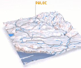 Places with similar names to Paloč, Bosnia and Herzegovina ::
Disclaimer :: Information on this page comes without warranty of any kind |
||
|
Where is Paloč? Elevation and coordinates ::
Latitude (lat): 43°55'25"N Longitude (lon): 17°34'3"E
Elevation (approx.): 811m (map arrows pan, magnifying glasses zoom) |
||
|
Visiting Paloč? Hotel/Accommodation ::
Book a hotel in Paloč Travel Guide ::
rental cars ::
car rental offers GPS waypoint ::
download a GPX waypoint (PoI) of Paloč for your GPS receiver
|
||