|
search place name
|
||
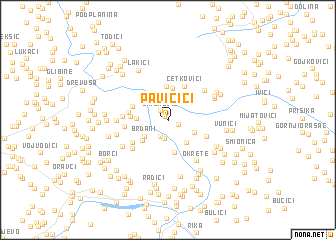
Pavičići (Federacija Bosne i Hercegovine, Bosnia and Herzegovina)Pavičići is a town in the Federacija Bosne i Hercegovine region of Bosnia and Herzegovina. An overview map of the region around Pavičići is displayed below.
regional and 3d topo map of Pavičići, Bosnia and Herzegovina ::
Pavičići airports ::
The nearest airport is SJJ - Sarajevo, located 109.1 km south east of Pavičići.
Other airports nearby include SPU - Split (125.3 km south west), OMO - Mostar (135.9 km south), ZAD - Zadar (156.6 km west), OSI - Osijek (168.0 km north east), Nearby towns ::
Podovi (0.4km north west) //
Šimunović (1.1km north west) //
Perak (1.0km south east) //
Barevo (1.9km south) //
Gladovići (2.1km south) //
Tomaši (2.5km south east) //
Brđani (2.6km south west) //
Zdaljevac (2.9km south east) //
Panići (3.3km north) //
Šahmani (2.5km west) //
Bregovi (3.5km north) //
Zečevo (3.0km south west) //
Tomaši (3.7km north) //
Zabrdo (3.7km south) //
Vlasinje (3.0km west) //
Pilići (3.2km north west) //
Ćetkovići (4.0km north) //
Drece (3.2km west) //
Šebezi (3.8km south west) //
Donji Bešpelj (3.6km south east) //
Kuprešani (3.6km west) //
Položani (3.6km west) //
Perkovići (4.3km south west) //
Vukovići (4.3km north east) //
Okrete (5.1km south east) //
Potok (4.0km west) //
Laketići (4.4km north east) //
Mokri Lug (4.6km north east) //
Jovići (4.6km south west) //
[all distances 'as the bird flies' and approximate]  Places with similar names to Pavičići, Bosnia and Herzegovina ::
Disclaimer :: Information on this page comes without warranty of any kind |
||
|
Where is Pavičići? Elevation and coordinates ::
Latitude (lat): 44°25'45"N Longitude (lon): 17°15'25"E
Elevation (approx.): 853m (map arrows pan, magnifying glasses zoom) |
||
|
Visiting Pavičići? Hotel/Accommodation ::
Book a hotel in Pavičići Travel Guide ::
rental cars ::
car rental offers GPS waypoint ::
download a GPX waypoint (PoI) of Pavičići for your GPS receiver
|
||