|
search place name
|
||
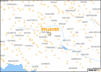
Prijevor (Federacija Bosne i Hercegovine, Bosnia and Herzegovina)Prijevor is a town in the Federacija Bosne i Hercegovine region of Bosnia and Herzegovina. An overview map of the region around Prijevor is displayed below.
regional and 3d topo map of Prijevor, Bosnia and Herzegovina ::
Prijevor airports ::
The nearest airport is OMO - Mostar, located 43.4 km north of Prijevor.
Other airports nearby include DBV - Dubrovnik (46.1 km south east), TIV - Tivat (84.4 km south east), SJJ - Sarajevo (107.7 km north), TGD - Podgorica (123.1 km south east), Nearby towns ::
Trnčina (1.5km west) //
Rupni Do (2.2km south) //
Brestica (2.2km south west) //
Planjak (2.0km south west) //
Trnčina (2.3km south west) //
Velja Međa (2.6km north) //
Gaic (2.9km south) //
Vojevići (2.4km south west) //
Ravno (2.4km south east) //
Vujinovica Slši (3.2km north west) //
Dvrsnica (3.3km north east) //
Morašnica (3.1km west) //
Stara (4.2km south) //
Batkovići (4.2km north west) //
Čavaš (4.8km north) //
Čvaljina (4.3km south east) //
Zagorac (3.7km west) //
Kašići (4.5km north west) //
Velja Sela (4.1km north west) //
Lastva (5.2km north) //
Paraunići (5.4km south) //
Plitki Do (5.5km south) //
Orašje (4.8km north east) //
Vodeni Do (5.2km north west) //
Pećina (4.5km west) //
Brijeg (5.0km south west) //
Novi Put (5.0km north west) //
Cicrina (5.3km south west) //
Pobrđe (5.5km north west) //
[all distances 'as the bird flies' and approximate]  Places with similar names to Prijevor, Bosnia and Herzegovina ::
// Prijevor (BA)
// Prijevor (BA)
// Pīr Jāfar (PK)
// Pīr Jāfar (PK)
// Par-e Ja‘far (IR)
// Prijevori (CS)
// Prijevori (CS)
// Peräjävaara (SE)
// Prijevor (HR)
// Prijevor (CS)
Disclaimer :: Information on this page comes without warranty of any kind |
||
|
Where is Prijevor? Elevation and coordinates ::
Latitude (lat): 42°53'54"N Longitude (lon): 17°56'25"E
Elevation (approx.): 443m (map arrows pan, magnifying glasses zoom) |
||
|
Visiting Prijevor? Hotel/Accommodation ::
Book a hotel in Prijevor Travel Guide ::
rental cars ::
car rental offers GPS waypoint ::
download a GPX waypoint (PoI) of Prijevor for your GPS receiver
|
||